
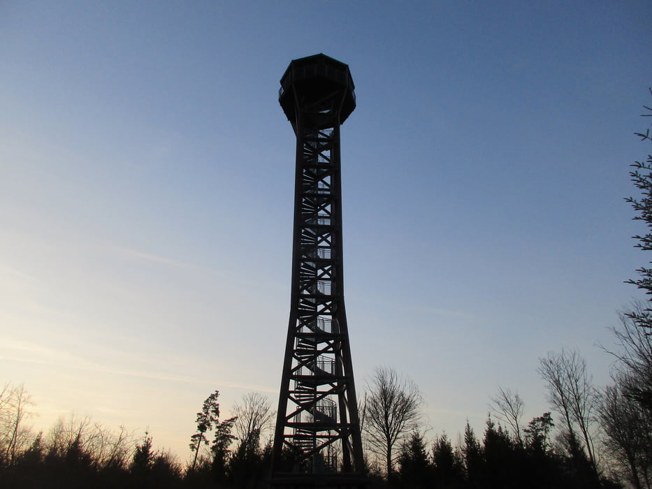

Wir starten in Pforzheims höchstgelenensten Stadtteil Hohenwart und wandern hinaus ins Biet -vorbei an Hohenwarter Köpfle und Hegarhütte- nach Hamberg und weiter zur St. Wendelinskappe. Danach machen wir einen kleinen, aussichtsreichen Bogen, um nach Neuhausen zu kommen. Weiter geht es zum Reiterhof Toll und danach hinüber nach Möttlingen. Möttlinger Kopf und Simmozheiemr Hörnle werden gestreift, Neuhengstellt anvisiert, ehe wir rechts abbiegen. Vorbei am Hofgut Georgenau geht es nun weiter, bald folgt eine grasige Wegphase bei Möttlingen, ehe es ein wenig feucht durch den Wald geht. Monakam wird anvisiert, ehe es rechts hinab zum Monbachtatl und der Monbachbrücke geht. Über sie drüber und hinauf durch Buntsandstein, ehe es gen Schellbronn und weiter zum Aussichtsturm Hohe Warte geht, dem höchsten hölzernen übrigens im Nordschwarzwald. Danach schließt sich dann der Wanderkreis.
Galerie du tour


Carte du tour et altitude
Minimum height 442 m
Maximum height 583 m
More about the tour author
|
|
Sigi2910 |
Commentaires

Tracks GPS
Trackpoints-
GPX / Garmin Map Source (gpx) download
-
TCX / Garmin Training Center® (tcx) download
-
CRS / Garmin Training Center® (crs) download
-
Google Earth (kml) download
-
G7ToWin (g7t) download
-
TTQV (trk) download
-
Overlay (ovl) download
-
Fugawi (txt) download
-
Kompass (DAV) Track (tk) download
-
Feuille de tours (pdf) download
-
Original file of the author (gpx) download
More about the tour author
|
|
Sigi2910 |
Add to my favorites
Remove from my favorites
Edit tags
Open track
My score
Rate