Login

Login oublié ?

Cookies have to be accepted!
Your browser's cookie functionality is disabled. Please enable this functionality.

Not a member yet?

Register now
Login

Available for registred users only

Log in to use this feature.

Login oublié ?

Cookies have to be accepted!
Your browser's cookie functionality is disabled. Please enable this functionality.

Not a member yet?

Register now
Filter
Catégories
Advanced filters
  • Longueur (km)
  • Altimètre
Enregistrer le filtre Reset filter

TrackRank

QRCode

Technical data

Longueur41,8 km Altimètre1061 m Way down1047 m Durée03:29 h:m Date21.07.2019
Evaluations Author Paysage Aspect amusement Condition Technique

Statistiques

305 Vues Evaluations 97 Téléchargements Moyenne
Rate
  • Feuille de tours
  • Arrivée
  • Téléchargements

Vom Lago Maggiore, Feriolo, den Fluss entlang bis Ornavasso.

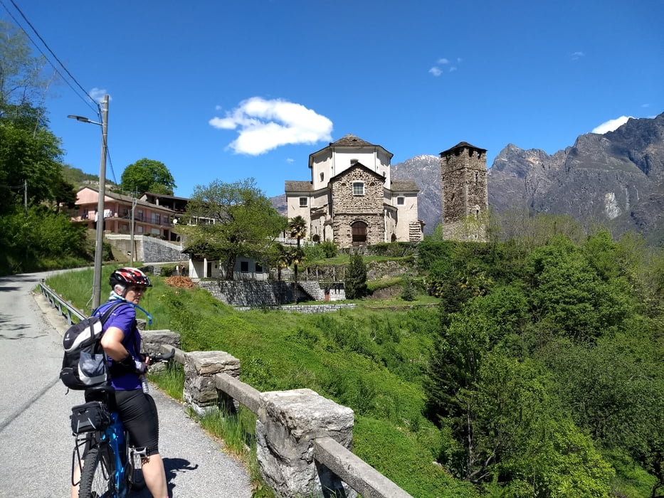
Hier jetzt bergauf zum Heiligtum Madonna del Boden. Die gesperrte Teerstraße weiter bergauf. Wir haben in Scirombei unser Ziel erreicht und nach Brotzeit wieder zurück zum Lago Maggiore gefahren. Man kann aber noch weiter und höher bis zur Alpe Corte Vecchio und Schutzhütte Brusa Perona fahren.

Carte du tour et altitude

  • Open Street Map
  • Google
Minimum height 194 m Maximum height 1227 m Vue de détail

More about the tour author

bernd_brinck
Member since 2011

Send private message

Commentaires

Lago Maggiore zwischen Feriolo und Verbania

Tracks GPS

Trackpoints
  • GPX / Garmin Map Source (gpx) download
  • TCX / Garmin Training Center® (tcx) download
  • CRS / Garmin Training Center® (crs) download
  • Google Earth (kml) download
  • G7ToWin (g7t) download
  • TTQV (trk) download
  • Overlay (ovl) download
  • Fugawi (txt) download
  • Kompass (DAV) Track (tk) download
  • Feuille de tours (pdf) download
  • Original file of the author (gpx) download

More about the tour author

bernd_brinck
Member since 2011

Send private message
Share track
Add to my favorites
Remove from my favorites
Edit tags
My score
Rate
Tour: Ornavasso
Cat.: Mountainbike
Longueur: 41,8 km
Evaluated on:
Durée:
Day(s)
Hour(s)
Minute(s)
Evaluation: Paysage Aspect amusement Condition Technique