Gossensaß-Sterzing-Moarerbergalm-Schneebergscharte-
Schneeberghaus-Moos im Passeier-Pfelders
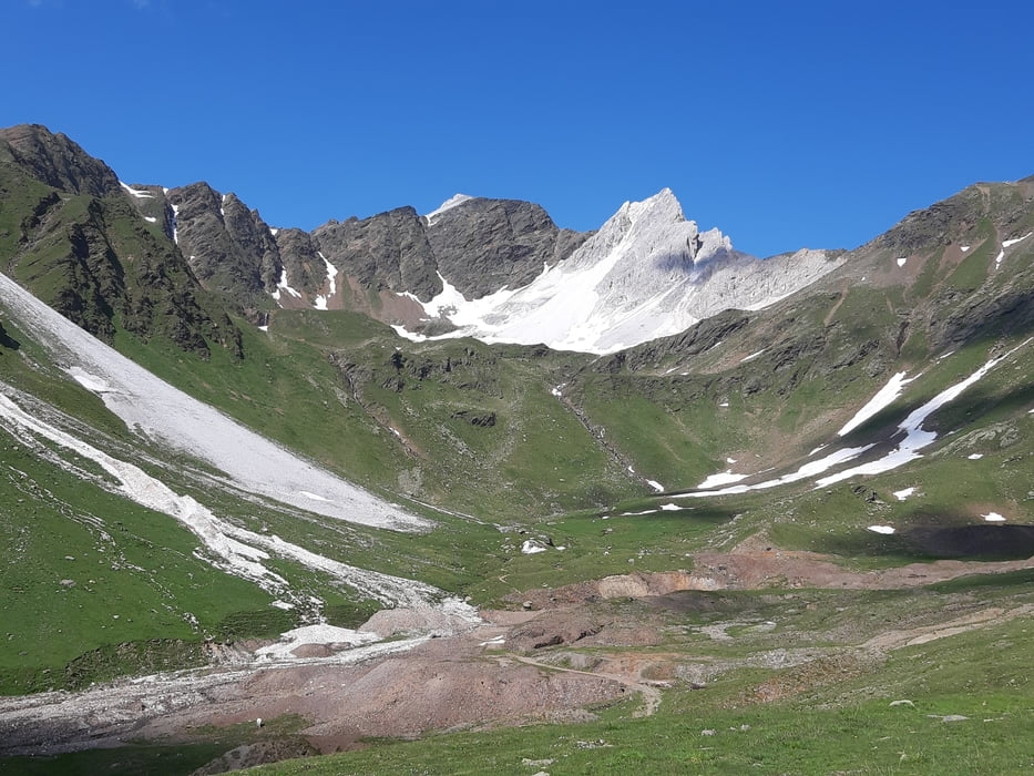
Von Gossensaß die Bundesstraße rasch runter nach Sterzing (Achtung: ein paar Tunneldurchfahrten, Licht!). Dann oberhalb vom Ridnauntal auf schöner Nebenstraße unterwegs. Am Telfer Berg dann eine ca 15' Schiebung einem Fußweg entlang. In Maiern spontan die Bremsen anschauen lassen - hat leider nichts genützt. Vom Bergwerksmuseum geht's zunächst sehr steil bergan, später passable Steigung auf Schotter zur Moarerbergalm. (Keine Einkehrempfehlung!) Von da beginnt der mühsame Anstieg zur Schneebergscharte: ca 550 hm, zwei Stunden schieben und tragen! Oben sensationeller Panoramablick! Runter noch mal ca 20' schieben, am Schneeberghaus vorbei kann man schon fahren. Die weitere Abfahrt ist möglich aber nicht ganz easy, die letzten km bergab im Brausetempo auf der Straße bis Moos i.P. Von dort nochmal 4 km steile Straße zum GH Bruggstein vor Pfelders: = Quartier: sehr empfehlenswert, weil freundlich, günstig und hervorragende Küche! HP 45 €.
Von Gossensaß die Bundesstraße rasch runter nach Sterzing (Achtung: ein paar Tunneldurchfahrten, Licht!). Dann oberhalb vom Ridnauntal auf schöner Nebenstraße unterwegs. Am Telfer Berg dann eine ca 15' Schiebung einem Fußweg entlang. In Maiern spontan die Bremsen anschauen lassen - hat leider nichts genützt. Vom Bergwerksmuseum geht's zunächst sehr steil bergan, später passable Steigung auf Schotter zur Moarerbergalm. (Keine Einkehrempfehlung!) Von da beginnt der mühsame Anstieg zur Schneebergscharte: ca 550 hm, zwei Stunden schieben und tragen! Oben sensationeller Panoramablick! Runter noch mal ca 20' schieben, am Schneeberghaus vorbei kann man schon fahren. Die weitere Abfahrt ist möglich aber nicht ganz easy, die letzten km bergab im Brausetempo auf der Straße bis Moos i.P. Von dort nochmal 4 km steile Straße zum GH Bruggstein vor Pfelders: = Quartier: sehr empfehlenswert, weil freundlich, günstig und hervorragende Küche! HP 45 €.
Further information at
http://www.bruggstein.com/Galerie du tour
Carte du tour et altitude
Minimum height 952 m
Maximum height 2670 m
Commentaires

Start in Gossensaß GH Moarwirt.
Tracks GPS
Trackpoints-
GPX / Garmin Map Source (gpx) download
-
TCX / Garmin Training Center® (tcx) download
-
CRS / Garmin Training Center® (crs) download
-
Google Earth (kml) download
-
G7ToWin (g7t) download
-
TTQV (trk) download
-
Overlay (ovl) download
-
Fugawi (txt) download
-
Kompass (DAV) Track (tk) download
-
Feuille de tours (pdf) download
-
Original file of the author (gpx) download
Add to my favorites
Remove from my favorites
Edit tags
Open track
My score
Rate


