


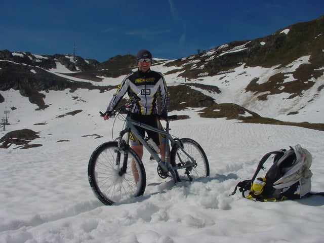
Zu beginn radelt man über den Brief (Gstüd) in Richtung Kropfen. Ab dort beginnt dann die Schotterstrasse. Am Hochjoch angekommen ist eine kleine Pause Pflicht. Ab dort geht es dann über die Skipiste Seebliga in Richtung Skitunnel. Hat man Diesen durchquert befinden wir Uns im Seetal, welches bei Uns leider noch mit Schnee bedeckt war. Kein Problem! Bike auf die Schulter und ab geht’s. Schlussendlich kommt man zum Höchstpunkt auf dem Kreuzjochsattel mit 2380m. Nun gilt es nur noch das lange Grasjoch hinab zu brettern. Bei der Grasjoch Talstation kommt man wieder auf die Schotterstrasse, welche nach St. Gallenkirch im schönen Montafon führt. Von dort kann man auf dem Radweg wieder zurück nach Schruns fahren.
Further information at
http://www.montafon.atGalerie du tour

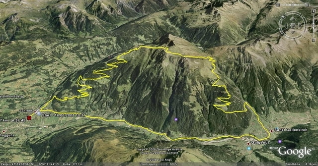
Carte du tour et altitude
Minimum height 704 m
Maximum height 2373 m
More about the tour author
|
|
bima1105 |
Commentaires

Am besten beginnt man die Tour beim Aktivpark in Schruns. Dort gibt es ausreichend kostenlose Parkplätze. Man findet den Aktivpark, wenn man die Montafoner Straße 188 folgt, bis man auf der rechten Seite ein großes Zelt und auf der linken Seite die tolle Anlage des FC-Schruns mit 3 großen Fußballplätzen vor sich sieht.
Tracks GPS
Trackpoints-
GPX / Garmin Map Source (gpx) download
-
TCX / Garmin Training Center® (tcx) download
-
CRS / Garmin Training Center® (crs) download
-
Google Earth (kml) download
-
G7ToWin (g7t) download
-
TTQV (trk) download
-
Overlay (ovl) download
-
Fugawi (txt) download
-
Kompass (DAV) Track (tk) download
-
Feuille de tours (pdf) download
-
Original file of the author (gpx) download
More about the tour author
|
|
bima1105 |
Add to my favorites
Remove from my favorites
Edit tags
Open track
My score
Rate