Login

Login oublié ?

Cookies have to be accepted!
Your browser's cookie functionality is disabled. Please enable this functionality.

Not a member yet?

Register now
Login

Available for registred users only

Log in to use this feature.

Login oublié ?

Cookies have to be accepted!
Your browser's cookie functionality is disabled. Please enable this functionality.

Not a member yet?

Register now
Filter
Catégories
Advanced filters
  • Longueur (km)
  • Altimètre
Enregistrer le filtre Reset filter

TrackRank

QRCode

Technical data

Longueur8,2 km Altimètre358 m Way down352 m Durée02:33 h:m Date14.10.2019
Evaluations Author Paysage Aspect amusement Condition Technique

Statistiques

1794 Vues Evaluations 12 Téléchargements Moyenne
Rate
  • Feuille de tours
  • Arrivée
  • Téléchargements

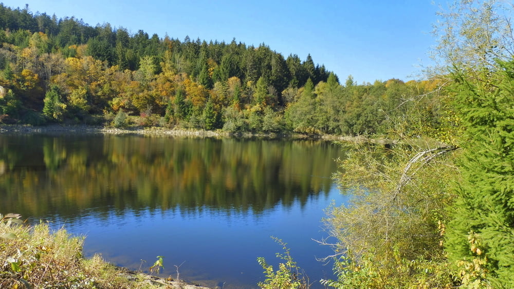
Rundwanderung am Saulochbach bis Rohrmünzmühle, über Greising und Tattenberg wieder zurück.

Vom Parkplatz an der Zufahrt zur Saulochschlucht auf Wanderweg Nr. 1 Richtung Rohrmünzmühle vorbei am Hochspeicher Saulochbach bis Gemeindeverbindungsstraße DEG 19. Auf dieser Richtung Greising bis zum "Nest". Von hier auf einem Pfad wieder zur DEG 19 bis Greising. Von Greising auf dem Böhmweg über Tattenberg zurück zum Ausgangspunkt.

Galerie du tour

Carte du tour et altitude

  • Open Street Map
  • Google
Minimum height 447 m Maximum height 798 m Vue de détail

More about the tour author

ejee
Member since 2019

Send private message

Commentaires

Tracks GPS

Trackpoints
  • GPX / Garmin Map Source (gpx) download
  • TCX / Garmin Training Center® (tcx) download
  • CRS / Garmin Training Center® (crs) download
  • Google Earth (kml) download
  • G7ToWin (g7t) download
  • TTQV (trk) download
  • Overlay (ovl) download
  • Fugawi (txt) download
  • Kompass (DAV) Track (tk) download
  • Feuille de tours (pdf) download
  • Original file of the author (gpx) download

More about the tour author

ejee
Member since 2019

Send private message
Share track
Add to my favorites
Remove from my favorites
Edit tags
My score
Rate
Tour: Durch die Saulochschlucht nach Greising
Cat.: Randonnées
Longueur: 8,2 km
Evaluated on:
Durée:
Day(s)
Hour(s)
Minute(s)
Evaluation: Paysage Aspect amusement Condition Technique