


Die Tour beginnt und endet am Parkplatz hinter der Stadtpfarrkirche Maria Himmelfahrt. Auf schönen Waldwegen geht es vorbei am Deggendorfer "Weinberg" zur Wallfahrtskirche "Zur schmerzhaften Mutter Gottes". Sehenswert sind hier die zum Teil uralten Votivtafeln.
Wir überqueren die Findelsteiner Straße und wandern weiter zum Gefallenenhain. An den Bäumen sind die Namen von gefallenen Soldaten der beiden letzten Kriege vermerkt.
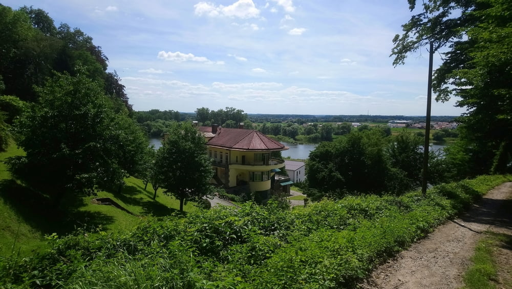
Jetzt geht es bergab bis wir die Donau im Blick haben. Jetzt rechts ein paar Stufen hinauf und zurück bis zur Wallfahrtskirche. Wir überqueren wieder die Straße und folgen dew Weg am Waldrand zurück zum Ausgangspunkt.
Galerie du tour


Carte du tour et altitude
Minimum height 321 m
Maximum height 399 m
More about the tour author

|
ejee |
Commentaires

Tracks GPS
Trackpoints-
GPX / Garmin Map Source (gpx) download
-
TCX / Garmin Training Center® (tcx) download
-
CRS / Garmin Training Center® (crs) download
-
Google Earth (kml) download
-
G7ToWin (g7t) download
-
TTQV (trk) download
-
Overlay (ovl) download
-
Fugawi (txt) download
-
Kompass (DAV) Track (tk) download
-
Feuille de tours (pdf) download
-
Original file of the author (gpx) download
More about the tour author
|
|
ejee |
Add to my favorites
Remove from my favorites
Edit tags
Open track
My score
Rate