
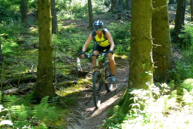

Schöner Mix aus Wurzelpassagen und "Strecke" auf Schotter.
Schöne Sonntag Vormittag Tour.
Carte du tour et altitude
Minimum height 483 m
Maximum height 583 m
More about the tour author
|
|
jupe05 |
Commentaires
Tracks GPS
Trackpoints-
GPX / Garmin Map Source (gpx) download
-
TCX / Garmin Training Center® (tcx) download
-
CRS / Garmin Training Center® (crs) download
-
Google Earth (kml) download
-
G7ToWin (g7t) download
-
TTQV (trk) download
-
Overlay (ovl) download
-
Fugawi (txt) download
-
Kompass (DAV) Track (tk) download
-
Feuille de tours (pdf) download
-
Original file of the author (gpx) download
More about the tour author
|
|
jupe05 |
Add to my favorites
Remove from my favorites
Edit tags
Open track
My score
Rate
April 2014
wir sind diese "Tour" im April nachgefahren. Ich würde diese Strecke nicht als Tour bezeichnen, sondern es ist eher ein Ausflug auf Forstwegen, welche man nach Belieben fahren kann. Die Strecke verläuft größtenteils auf Schotterwaldwegen. Trails oder Wurzelnpassagen sieht man sehr selten. Wir sind ab einem bestimmten Zeitpunkt von der Route runtergefahren, und haben eigene schöne Wege gefunden, welche mehr Spaß machten als auf Forstwegen durch den Wald zu fahren.
Ich würde die Tour nicht weiter empfehlen/erneut fahren, obwohl es generel ein schönes Gebiet zum Mountainbiken ist.