Login

Login oublié ?

Cookies have to be accepted!
Your browser's cookie functionality is disabled. Please enable this functionality.

Not a member yet?

Register now
Login

Available for registred users only

Log in to use this feature.

Login oublié ?

Cookies have to be accepted!
Your browser's cookie functionality is disabled. Please enable this functionality.

Not a member yet?

Register now
Filter
Catégories
Advanced filters
  • Longueur (km)
  • Altimètre
Enregistrer le filtre Reset filter

TrackRank

QRCode

Technical data

Longueur11,3 km Altimètre302 m Way down328 m Durée04:15 h:m Date20.09.2020
Evaluations Author Paysage Aspect amusement Condition Technique

Statistiques

1647 Vues Evaluations 27 Téléchargements Moyenne
Rate
  • Feuille de tours
  • Arrivée
  • Téléchargements

Beschauliche Wanderung durchs wilde Erlautal nach Kellberg und über die König-Max-Höhe wieder zurück.

Von der Holzschleife folgen wir der Erlau auf ihrem Lauf bis Schmölz. Hier verlassen wir das Erlautal und wandern über die Eggersdorfer Teiche und Kellberg zur König-Max-Höhe und genießen die schöne Aussicht in den Bayerischen Wald bevor es hinuntergeht zum Ausgangspunkt unserer Wanderung.

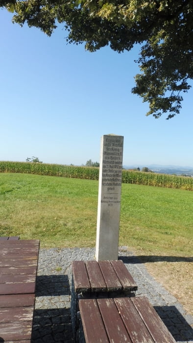
POI: Holzschleife, Erlautal, König-Max-Höhe

Galerie du tour

Carte du tour et altitude

  • Open Street Map
  • Google
Minimum height 304 m Maximum height 521 m Vue de détail

More about the tour author

ejee
Member since 2019

Send private message

Commentaires

Tracks GPS

Trackpoints
  • GPX / Garmin Map Source (gpx) download
  • TCX / Garmin Training Center® (tcx) download
  • CRS / Garmin Training Center® (crs) download
  • Google Earth (kml) download
  • G7ToWin (g7t) download
  • TTQV (trk) download
  • Overlay (ovl) download
  • Fugawi (txt) download
  • Kompass (DAV) Track (tk) download
  • Feuille de tours (pdf) download
  • Original file of the author (gpx) download

More about the tour author

ejee
Member since 2019

Send private message
Share track
Add to my favorites
Remove from my favorites
Edit tags
My score
Rate
Tour: Durchs wilde Erlautal zur König-Max-Höhe
Cat.: Randonnées
Longueur: 11,3 km
Evaluated on:
Durée:
Day(s)
Hour(s)
Minute(s)
Evaluation: Paysage Aspect amusement Condition Technique