Login

Login oublié ?

Cookies have to be accepted!
Your browser's cookie functionality is disabled. Please enable this functionality.

Not a member yet?

Register now
Login

Available for registred users only

Log in to use this feature.

Login oublié ?

Cookies have to be accepted!
Your browser's cookie functionality is disabled. Please enable this functionality.

Not a member yet?

Register now
Filter
Catégories
Advanced filters
  • Longueur (km)
  • Altimètre
Enregistrer le filtre Reset filter

TrackRank

QRCode

Technical data

Longueur6,8 km Altimètre360 m Way down341 m Durée02:30 h:m Date30.03.2022
Evaluations Author Paysage Aspect amusement Condition Technique

Statistiques

83 Vues Evaluations 2 Téléchargements Moyenne
Rate
  • Feuille de tours
  • Arrivée
  • Téléchargements

Start ist Guia de Isora im Süden von Teneriffa schon etwas oberhalb der Küste. Man hat schon von da einen Überblick über die Küste und hinüber zu den Nachbarinsel Gomera.

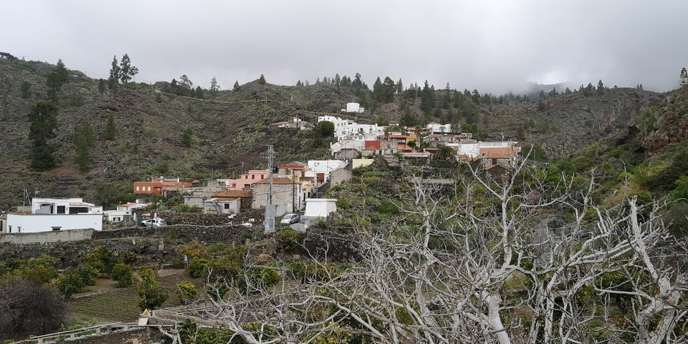
Der Weg zum kleinen Bergdorf Chirche ist dann leicht zu finden und gut Ausgeschildert. Am Anfang geht es über einen Weg durch Lavageröll. Die Landschaft ist wildromantisch mit einzelnen Mandelbäumen. Scheint die Sonne gibt es keinen Schatten.

Das Bergdorf besteht aus alten Häusern in verschiedenen Erhaltungsstadien. Von völlig Zerfallen bis Top restauriert ist alles dabei.

Etwas oberhalb des Dorfes (+10 Minuten) soll es ein Restaurant mit Aussichtsterrasse geben. Das haben wir jedoch nicht besucht da es sich bei unserem Besuch zuzog und wir komplett in den Wolken waren (dunkel, nass und kalt). Je weiter man dann absteigt desto freundlicher wurde es und an der Küste gab es dann Sonnenschein.

Galerie du tour

Carte du tour et altitude

  • Open Street Map
  • Google
Minimum height 622 m Maximum height 935 m Vue de détail

More about the tour author

JoachimDief
Member since 2016

Send private message

Commentaires

Nach Guia de Isora zum Kirchplatz fahren. Oberhalb vom Kirchplatz, vorbei an der Polizei gibt es dann einen kostenlosen Parkplatz.

Tracks GPS

Trackpoints
  • GPX / Garmin Map Source (gpx) download
  • TCX / Garmin Training Center® (tcx) download
  • CRS / Garmin Training Center® (crs) download
  • Google Earth (kml) download
  • G7ToWin (g7t) download
  • TTQV (trk) download
  • Overlay (ovl) download
  • Fugawi (txt) download
  • Kompass (DAV) Track (tk) download
  • Feuille de tours (pdf) download
  • Original file of the author (gpx) download

More about the tour author

JoachimDief
Member since 2016

Send private message
Share track
Add to my favorites
Remove from my favorites
Edit tags
My score
Rate
Tour: Von Guía de Isora nach Chirche
Cat.: Randonnées
Longueur: 6,8 km
Evaluated on:
Durée:
Day(s)
Hour(s)
Minute(s)
Evaluation: Paysage Aspect amusement Condition Technique