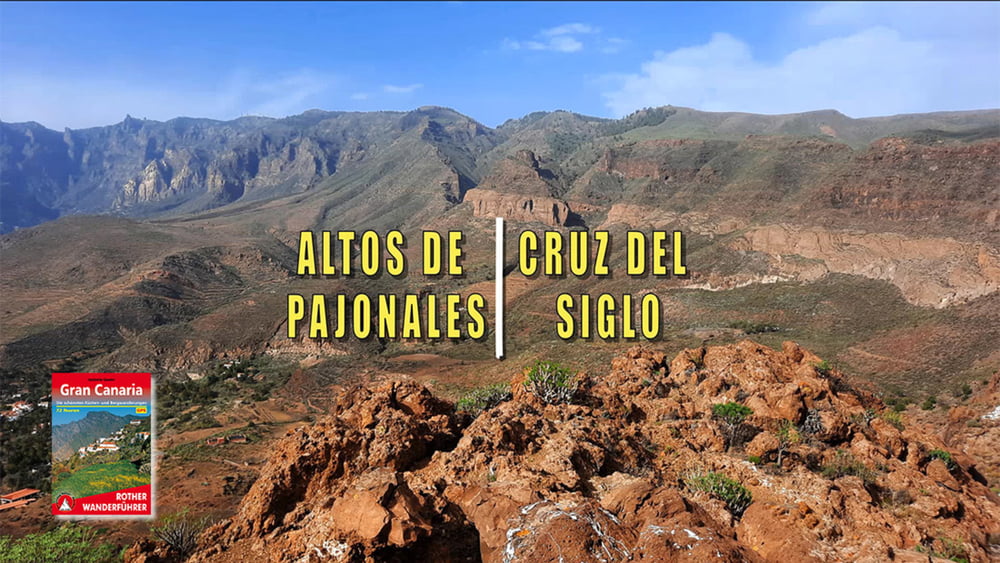
Login

Login oublié ?

Cookies have to be accepted!
Your browser's cookie functionality is disabled. Please enable this functionality.

Not a member yet?

Register now
Login

Available for registred users only

Log in to use this feature.

Login oublié ?

Cookies have to be accepted!
Your browser's cookie functionality is disabled. Please enable this functionality.

Not a member yet?

Register now
Filter
Catégories
Advanced filters
  • Longueur (km)
  • Altimètre
Enregistrer le filtre Reset filter

TrackRank

QRCode

Technical data

Longueur8,2 km Altimètre327 m Way down325 m Durée05:00 h:m Date02.02.2022
Evaluations Author Paysage Aspect amusement Condition Technique

Statistiques

152 Vues Evaluations 8 Téléchargements Moyenne
Rate
  • Feuille de tours
  • Arrivée
  • Téléchargements

Altos Pajonales

Steil geht es anfangs von Santa Lucia in eine ländlich geprägte Landschaft. Auf nicht bewirtschaftete Getreidefelder folgen die Ausläufer des Weilers Taidia, mit Orangenplantagen und Ziegen-Fincas. Steile und Höhehaltende Passagen wechseln sich ab. Der letzte Anstieg erfolgt dann zum Altos Pajonales. Auf einem Fahrweg, dann auf uns bekanntem Weg geht es zurück nach Santa Lucia.

Galerie du tour

Carte du tour et altitude

  • Open Street Map
  • Google
Minimum height 709 m Maximum height 1025 m Vue de détail

More about the tour author

schleidy
Member since 2013

Send private message

Commentaires

Tracks GPS

Trackpoints
  • GPX / Garmin Map Source (gpx) download
  • TCX / Garmin Training Center® (tcx) download
  • CRS / Garmin Training Center® (crs) download
  • Google Earth (kml) download
  • G7ToWin (g7t) download
  • TTQV (trk) download
  • Overlay (ovl) download
  • Fugawi (txt) download
  • Kompass (DAV) Track (tk) download
  • Feuille de tours (pdf) download
  • Original file of the author (gpx) download

More about the tour author

schleidy
Member since 2013

Send private message
Share track
Add to my favorites
Remove from my favorites
Edit tags
My score
Rate
Tour: Altos Pajonales
Cat.: Randonnées
Longueur: 8,2 km
Evaluated on:
Durée:
Day(s)
Hour(s)
Minute(s)
Evaluation: Paysage Aspect amusement Condition Technique