
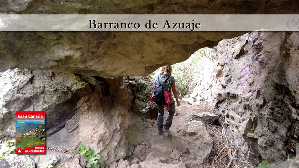

Das Auto parken wir auf einem Wanderparkplatz an der GC 305, am Ortsrand von Firgas. Von dort folgen wir einige Meter der Asphaltstraße bis wir in den Barranco hinabsteigen. Am Grund vom Bco. angelangt folgen wir dem Bach in fließ Richtung und wechseln mehrfach die Bachseite. An vormontierten Taue muss die eine oder andere Höhendifferenz überwunden werden. Bei dem verfallenen Kurhotel verlassen wir den Bco. und steigen über einen Serpentinenpfad steil nach Firgas auf. Nach einem Bummel durch den Ort geht es zum Wanderparkplatz zurück.
Galerie du tour


Carte du tour et altitude
Minimum height 165 m
Maximum height 437 m
More about the tour author
|
|
schleidy |
Commentaires

Tracks GPS
Trackpoints-
GPX / Garmin Map Source (gpx) download
-
TCX / Garmin Training Center® (tcx) download
-
CRS / Garmin Training Center® (crs) download
-
Google Earth (kml) download
-
G7ToWin (g7t) download
-
TTQV (trk) download
-
Overlay (ovl) download
-
Fugawi (txt) download
-
Kompass (DAV) Track (tk) download
-
Feuille de tours (pdf) download
-
Original file of the author (gpx) download
More about the tour author
|
|
schleidy |
Add to my favorites
Remove from my favorites
Edit tags
Open track
My score
Rate