
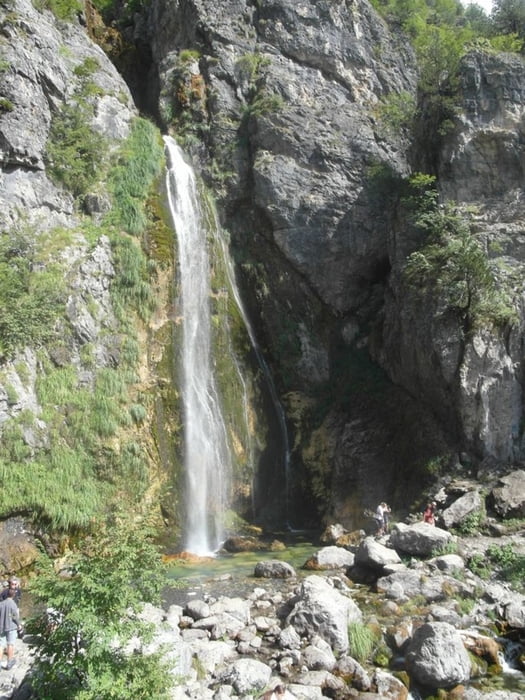

Einfache Runde von Theth zum Wasserfall und einem kleinen Steg über eine Schlucht. Die Tour stammt aus dem empfehlenwerten Wanderführer von asd, dort finden sich auch Erläuterungen zu den kulturellen Highlights entlang des Weges.
Die Tour ist eigentlich ein Spaziergang, doch für die paar Meter Aufstieg zum Wasserfall sind gute Schuhe von Vorteil. Die Tour folgt dem üblichen Weg, den alle Leute gehen. Auf dem Rückweg habe ich nicht die beschriebene Strecke gefunden, aber diese ist auch schön.
Carte du tour et altitude
Minimum height 648 m
Maximum height 781 m
More about the tour author

|
Rum2014 |
Commentaires

Tracks GPS
Trackpoints-
GPX / Garmin Map Source (gpx) download
-
TCX / Garmin Training Center® (tcx) download
-
CRS / Garmin Training Center® (crs) download
-
Google Earth (kml) download
-
G7ToWin (g7t) download
-
TTQV (trk) download
-
Overlay (ovl) download
-
Fugawi (txt) download
-
Kompass (DAV) Track (tk) download
-
Feuille de tours (pdf) download
-
Original file of the author (gpx) download
More about the tour author
|
|
Rum2014 |
Add to my favorites
Remove from my favorites
Edit tags
Open track
My score
Rate