Login

Login oublié ?

Cookies have to be accepted!
Your browser's cookie functionality is disabled. Please enable this functionality.

Not a member yet?

Register now
Login

Available for registred users only

Log in to use this feature.

Login oublié ?

Cookies have to be accepted!
Your browser's cookie functionality is disabled. Please enable this functionality.

Not a member yet?

Register now
Filter
Catégories
Advanced filters
  • Longueur (km)
  • Altimètre
Enregistrer le filtre Reset filter

TrackRank

QRCode

Technical data

Longueur70,1 km Altimètre1347 m Way down1380 m Durée06:50 h:m Date02.07.2008
Evaluations Author Paysage Aspect amusement Condition Technique

Statistiques

2342 Vues Evaluations 271 Téléchargements Moyenne
Rate
  • Feuille de tours
  • Arrivée
  • Téléchargements
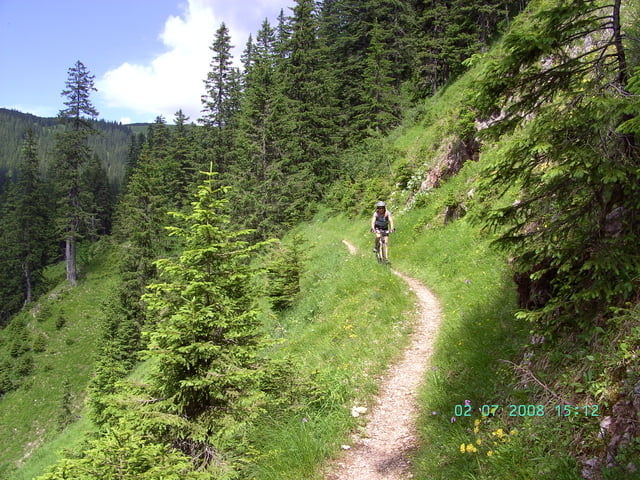
Sehr schöne Rundtour durch das Ammergebirge mit interessantem Trail von der Enningalm. Vom Parkplatz nach Schloß Linderhof bis zum Rothornsattel ist die Tour fast identisch mit der Tour Nr. 5631. Wir starteten am Plansee.

Galerie du tour

Carte du tour et altitude

  • Open Street Map
  • Google
Minimum height 669 m Maximum height 1567 m Vue de détail

More about the tour author

yr1willi
Member since 2006

Send private message

Commentaires

über Reutte (Tirol) zum Plansee

Tracks GPS

Trackpoints
  • GPX / Garmin Map Source (gpx) download
  • TCX / Garmin Training Center® (tcx) download
  • CRS / Garmin Training Center® (crs) download
  • Google Earth (kml) download
  • G7ToWin (g7t) download
  • TTQV (trk) download
  • Overlay (ovl) download
  • Fugawi (txt) download
  • Kompass (DAV) Track (tk) download
  • Feuille de tours (pdf) download
  • Original file of the author (gpx) download

More about the tour author

yr1willi
Member since 2006

Send private message
Share track
Add to my favorites
Remove from my favorites
Edit tags
My score
Rate
Tour: Enningalm
Cat.: Mountainbike
Longueur: 70,1 km
Evaluated on:
Durée:
Day(s)
Hour(s)
Minute(s)
Evaluation: Paysage Aspect amusement Condition Technique