Login

Login oublié ?

Cookies have to be accepted!
Your browser's cookie functionality is disabled. Please enable this functionality.

Not a member yet?

Register now
Login

Available for registred users only

Log in to use this feature.

Login oublié ?

Cookies have to be accepted!
Your browser's cookie functionality is disabled. Please enable this functionality.

Not a member yet?

Register now
Filter
Catégories
Advanced filters
  • Longueur (km)
  • Altimètre
Enregistrer le filtre Reset filter

TrackRank

QRCode

Technical data

Longueur33,6 km Altimètre1063 m Way down1063 m Durée00:00 h:m Date29.07.2008
Evaluations Author Paysage Aspect amusement Condition Technique

Statistiques

1264 Vues Evaluations 190 Téléchargements Moyenne
Rate
  • Feuille de tours
  • Arrivée
  • Téléchargements

Von VAlangin, nehmen Sie Feld und Single track  im "Chanet Wald".  Nachher, machen Sie ein Aufstiege bis la Grand Sagneule auf Schotter und Asphalt. Es gibt ein kleine Trage bis Mont Racine Kamm.

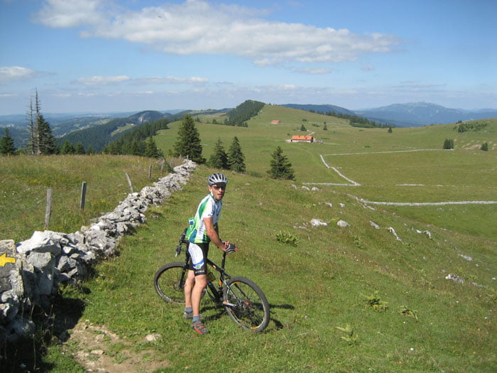
SIe folgen Mont Racine Kalm auf Feld und Single Track. Es gibt sehr schöne Panorama.

Bis Tête de Ran Restaurant, nehmen sie ein grosse Abfahrte auf Single Track, Schotter und Asphalt bis Valangin.

Galerie du tour

Carte du tour et altitude

  • Open Street Map
  • Google
Minimum height 687 m Maximum height 1484 m Vue de détail

More about the tour author

preusser
Member since 2007

Send private message

Commentaires

Valangin, neben von Neuchatel

Tracks GPS

Trackpoints
  • GPX / Garmin Map Source (gpx) download
  • TCX / Garmin Training Center® (tcx) download
  • CRS / Garmin Training Center® (crs) download
  • Google Earth (kml) download
  • G7ToWin (g7t) download
  • TTQV (trk) download
  • Overlay (ovl) download
  • Fugawi (txt) download
  • Kompass (DAV) Track (tk) download
  • Feuille de tours (pdf) download
  • Original file of the author (gpx) download

More about the tour author

preusser
Member since 2007

Send private message
Share track
Add to my favorites
Remove from my favorites
Edit tags
My score
Rate
Tour: Valangin - Mont Racin
Cat.: Mountainbike
Longueur: 33,6 km
Evaluated on:
Durée:
Day(s)
Hour(s)
Minute(s)
Evaluation: Paysage Aspect amusement Condition Technique