


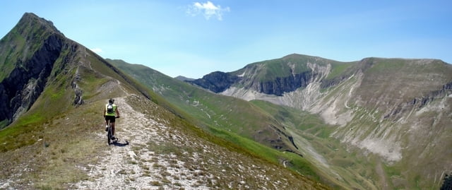
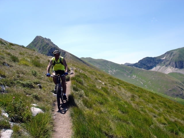
Da Pintura di Bolognola si sale sul versante est di Monte Castelmanardo fino al Casale Grascete in Val d’Ambro da dove si continua fino ad arrivare a Casale Rinaldi posto alla testa della valle. Da qui un ripido sentiero (che ci costringe a scendere) ci fa superare i 300 metri di dislivello che ci separano dalla Forcella Angagnola da dove la superba vista sul Monte Priora e la sottostante Val di Panico compensa ampiamente lo sforzo dell’ascesa. Un sentiero in leggera discesa (attenzione perché è stretto e su pendio scosceso) ci conduce al Rifugio del Fargno da dove scende la strada per la Pintura di Bolognola. Noi, a metà discesa, abbiamo scelto di scendere dentro l’angusta e selvaggia Valle del Fargno, dove scorre il Torrente Fiastrone, e di risalire poi alla Pintura per la strada Provinciale (variante difficile e poco pedalabile).
Further information at
http://www.sibillini-mtb.itGalerie du tour


Carte du tour et altitude
Minimum height 1133 m
Maximum height 1914 m
More about the tour author
|
|
barbonis |
Commentaires

Tracks GPS
Trackpoints-
GPX / Garmin Map Source (gpx) download
-
TCX / Garmin Training Center® (tcx) download
-
CRS / Garmin Training Center® (crs) download
-
Google Earth (kml) download
-
G7ToWin (g7t) download
-
TTQV (trk) download
-
Overlay (ovl) download
-
Fugawi (txt) download
-
Kompass (DAV) Track (tk) download
-
Feuille de tours (pdf) download
-
Original file of the author (gpx) download
More about the tour author
|
|
barbonis |
Add to my favorites
Remove from my favorites
Edit tags
Open track
My score
Rate