Login

Login oublié ?

Cookies have to be accepted!
Your browser's cookie functionality is disabled. Please enable this functionality.

Not a member yet?

Register now
Login

Available for registred users only

Log in to use this feature.

Login oublié ?

Cookies have to be accepted!
Your browser's cookie functionality is disabled. Please enable this functionality.

Not a member yet?

Register now
Filter
Catégories
Advanced filters
  • Longueur (km)
  • Altimètre
Enregistrer le filtre Reset filter

TrackRank

QRCode

Technical data

Longueur17,1 km Altimètre416 m Way down425 m Durée03:11 h:m Date08.08.2008
Evaluations Author Paysage Aspect amusement Condition Technique

Statistiques

887 Vues Evaluations 71 Téléchargements Moyenne
Rate
  • Feuille de tours
  • Arrivée
  • Téléchargements

Eine sehr gute Wegbeschreibung findet sich unter dem unten aufgeführtem Link.

Die Höhepunkte der Wanderung sind

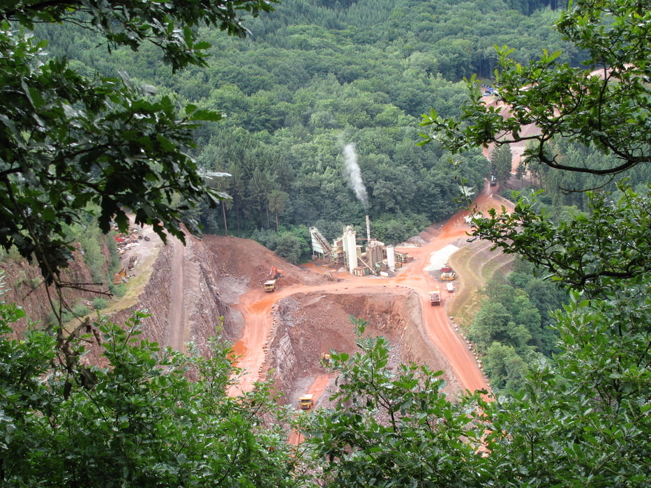
  • die Ausblicke auf die Steinbrüche
  • der Hundscheider Weiher (schön ruhig gelegen, aber leider ohne Pausenbank)
  • der Aussichtspunkt mit Blick auf den Vogelfelsen
Der Weg führt überwiegend auf breiten Wegen durch den Wald. Es gibt unterwegs keine Einkehrmöglichkeit.

Further information at

http://www.wanderbares-saarland.de/db/touren/taben_saarh/taben_saarh.html

Galerie du tour

Carte du tour et altitude

  • Open Street Map
  • Google
Minimum height 166 m Maximum height 480 m Vue de détail

More about the tour author

Wanderwolf

Commentaires

Start: Bahnhof Taben (kein Fahrscheinautomat)

Ziel: Bahnhof Saarhölzbach

Tracks GPS

Trackpoints
  • GPX / Garmin Map Source (gpx) download
  • TCX / Garmin Training Center® (tcx) download
  • CRS / Garmin Training Center® (crs) download
  • Google Earth (kml) download
  • G7ToWin (g7t) download
  • TTQV (trk) download
  • Overlay (ovl) download
  • Fugawi (txt) download
  • Kompass (DAV) Track (tk) download
  • Feuille de tours (pdf) download
  • Original file of the author (gpx) download

More about the tour author

Wanderwolf

Share track
Add to my favorites
Remove from my favorites
Edit tags
My score
Rate
Tour: Von Taben nach Saarhölzbach
Cat.: Randonnées
Longueur: 17,1 km
Evaluated on:
Durée:
Day(s)
Hour(s)
Minute(s)
Evaluation: Paysage Aspect amusement Condition Technique