Login

Login oublié ?

Cookies have to be accepted!
Your browser's cookie functionality is disabled. Please enable this functionality.

Not a member yet?

Register now
Login

Available for registred users only

Log in to use this feature.

Login oublié ?

Cookies have to be accepted!
Your browser's cookie functionality is disabled. Please enable this functionality.

Not a member yet?

Register now
Filter
Catégories
Advanced filters
  • Longueur (km)
  • Altimètre
Enregistrer le filtre Reset filter

TrackRank

QRCode

Technical data

Longueur154,3 km Altimètre2763 m Way down2761 m Durée08:00 h:m Date13.08.2008
Evaluations Author Paysage Aspect amusement Condition Technique

Statistiques

1982 Vues Evaluations 183 Téléchargements Moyenne
Rate
  • Feuille de tours
  • Arrivée
  • Téléchargements

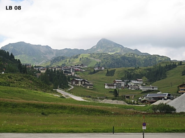
Zwei großartige Pässe sind in dieser Schladming Tauern Radtour enthalten. Zuerst der Sölkpass 1790Hm im Naturpark Sölktäler und dann der Radstätter Tauernpass 1730Hm mit dem beliebten Schiort Obertauern. Aber auch die restlichen Kilometer machen aus dieser Rundfahrt etwas ganz besonderes.


Weitere Infos und Fotos zur Schladming Tauern Radtour findest du auf

biketours4you.at


Carte du tour et altitude

  • Open Street Map
  • Google
Minimum height 671 m Maximum height 1792 m Vue de détail

More about the tour author

Trek1400d
Member since 2008

Send private message

Commentaires

Tracks GPS

Trackpoints
  • GPX / Garmin Map Source (gpx) download
  • TCX / Garmin Training Center® (tcx) download
  • CRS / Garmin Training Center® (crs) download
  • Google Earth (kml) download
  • G7ToWin (g7t) download
  • TTQV (trk) download
  • Overlay (ovl) download
  • Fugawi (txt) download
  • Kompass (DAV) Track (tk) download
  • Feuille de tours (pdf) download
  • Original file of the author (gpx) download

More about the tour author

Trek1400d
Member since 2008

Send private message
Share track
Add to my favorites
Remove from my favorites
Edit tags
My score
Rate
Tour: Sölkpass und Radstädter Tauernpass
Cat.: Vélo de course
Longueur: 154,3 km
Evaluated on:
Durée:
Day(s)
Hour(s)
Minute(s)
Evaluation: Paysage Aspect amusement Condition Technique