
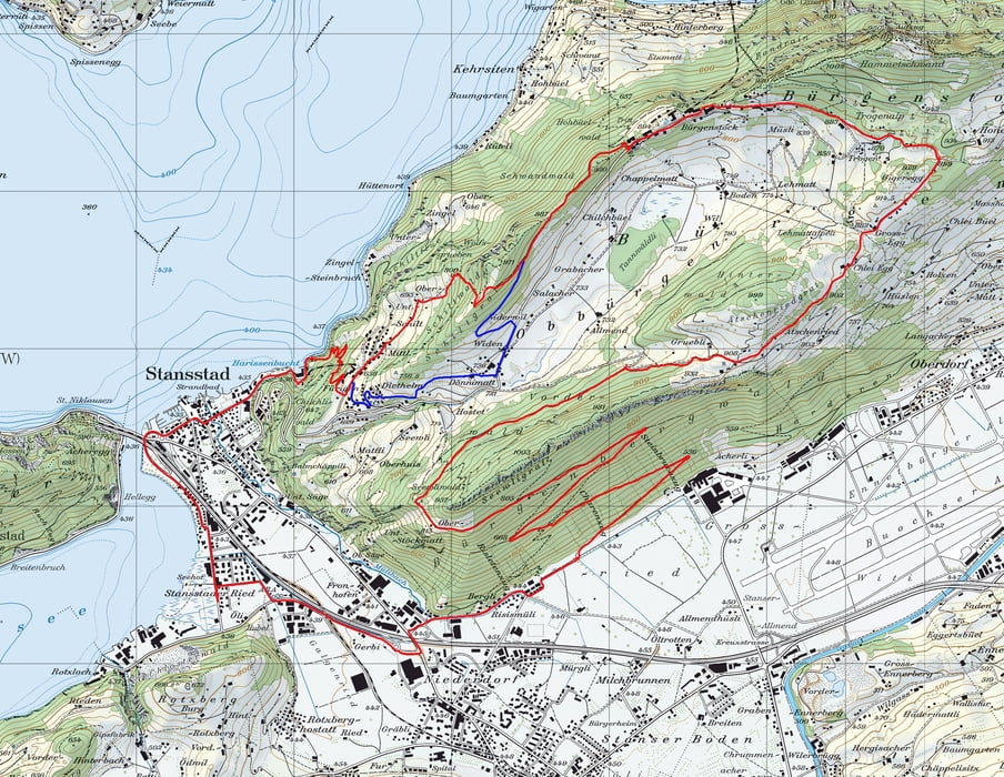

DIe Strecke führt von Stans her über eine gute Forststrasse hinauf zur Stöckmatt. Auf halbem weg kommt man durch ein Tunell, was aber auch ohne Lampe gut befahren werden kann.
Von der Stöckmat geht es zuerst kurz runter und dann zum Schlussanstieg hinauf zum Ätschenried, von wo aus man einen wunderbaren Ausblich auf den Vierwaldstättersee hat.
Dem Grat entlan zur Honeg und dann link zu den Bürgenstockhotels.
Von da Richtung Schiltgrat. (ung. beim Schitgrat muss man das Bike ca. 10 Minuten RUNTERTRAGEN!! Als Variante kann man den Schitgrat umgehen und dann von Fürigen aus auf den Schlusstrail hinunter zu fahren. Am Schluss sind ca. 30 Stufen welche nicht gefahren werden können, aber der Trail ist so schön dass man dies locker in Kuf nehmen kann.
Carte du tour et altitude
Minimum height 450 m
Maximum height 926 m
More about the tour author
|
|
Winkelried |
Commentaires

Tracks GPS
Trackpoints-
GPX / Garmin Map Source (gpx) download
-
TCX / Garmin Training Center® (tcx) download
-
CRS / Garmin Training Center® (crs) download
-
Google Earth (kml) download
-
G7ToWin (g7t) download
-
TTQV (trk) download
-
Overlay (ovl) download
-
Fugawi (txt) download
-
Kompass (DAV) Track (tk) download
-
Feuille de tours (pdf) download
-
Original file of the author (gpx) download
More about the tour author
|
|
Winkelried |
Add to my favorites
Remove from my favorites
Edit tags
Open track
My score
Rate