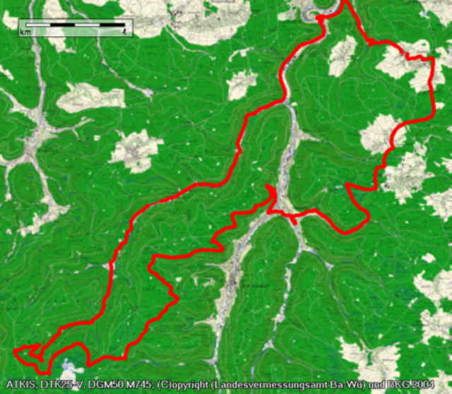
Das Eyachtal ist eine Fahrt wert. Die Natur zeigt sich von ihrer schönsten Seite, bei über 20km Bergauf hat man genug Zeit zum genießen.. Von Engelsbrand gehts hinab ins Enztal Richtung Höfen. Vor Höfen zeigt das Eyachtal rechts ab. Zuerst auf Asphalt, dann auf Schotter fährt man das Tal bis in den hintersten Winkel aus. Dann noch ein paar Höhenmeter und man ist an der Kreuzlehütte. Dann gehts auf einem Wanderweg über die Grünhütte (Pause mit einem Pfannkuchen!), Soldatenbrunnen und Drei Kreuze nach Calmbach. Über Schömberg gehts dann zurück nach Engelsbrand.
Galerie du tour
Carte du tour et altitude
Minimum height -5 m
Maximum height 859 m
Commentaires
A8 nach Pforzheim, dann Richtung Schömberg
Tracks GPS
Trackpoints-
GPX / Garmin Map Source (gpx) download
-
TCX / Garmin Training Center® (tcx) download
-
CRS / Garmin Training Center® (crs) download
-
Google Earth (kml) download
-
G7ToWin (g7t) download
-
TTQV (trk) download
-
Overlay (ovl) download
-
Fugawi (txt) download
-
Kompass (DAV) Track (tk) download
-
Feuille de tours (pdf) download
-
Original file of the author (gpx) download
Add to my favorites
Remove from my favorites
Edit tags
Open track
My score
Rate


tolle Tour
Es war ein schöner Tag, schöne Landschaft, super Heidel beerpfannkuchen, tolles Wetter. Werde die Tour sicher nochmals fahren, dann komplett.