Login

Login oublié ?

Cookies have to be accepted!
Your browser's cookie functionality is disabled. Please enable this functionality.

Not a member yet?

Register now
Login

Available for registred users only

Log in to use this feature.

Login oublié ?

Cookies have to be accepted!
Your browser's cookie functionality is disabled. Please enable this functionality.

Not a member yet?

Register now
Filter
Catégories
Advanced filters
  • Longueur (km)
  • Altimètre
Enregistrer le filtre Reset filter

TrackRank

QRCode

Technical data

Longueur28,4 km Altimètre711 m Way down712 m Durée02:45 h:m Date01.09.2008
Evaluations Author Paysage Aspect amusement Condition Technique

Statistiques

597 Vues Evaluations 76 Téléchargements Moyenne
Rate
  • Feuille de tours
  • Arrivée
  • Téléchargements

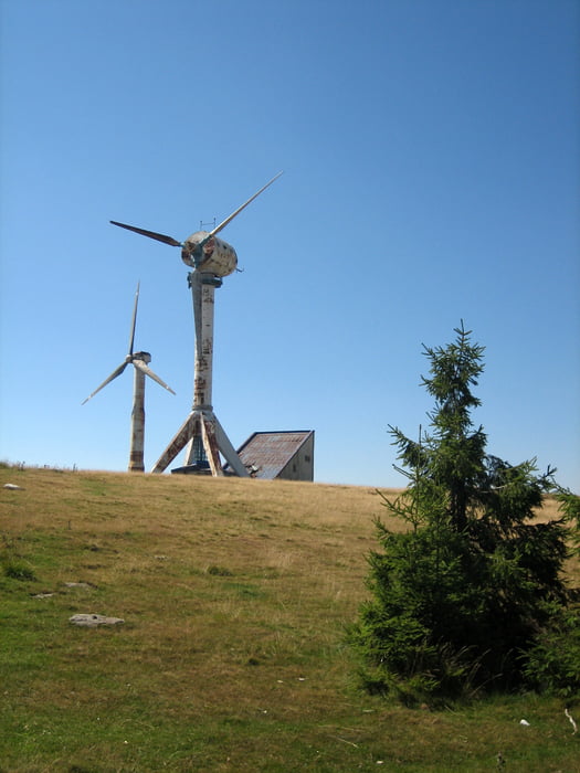
Auffahrt zum skurrilen "Skiresort" Semenic (oder was noch davon übriggeblieben ist) ... dann traumhafter Downhill im Wald des Nationalparks.


Viel Spass!


Leider ist die Angabe der Höhe im Profil um 1000hm zu groß.  Die gefahrenen Höhenmeter stimmen aber...

Galerie du tour

Carte du tour et altitude

  • Open Street Map
  • Google
Minimum height 1785 m Maximum height 2305 m Vue de détail

More about the tour author

td-henner
Member since 2008

Send private message

Commentaires

Tracks GPS

Trackpoints
  • GPX / Garmin Map Source (gpx) download
  • TCX / Garmin Training Center® (tcx) download
  • CRS / Garmin Training Center® (crs) download
  • Google Earth (kml) download
  • G7ToWin (g7t) download
  • TTQV (trk) download
  • Overlay (ovl) download
  • Fugawi (txt) download
  • Kompass (DAV) Track (tk) download
  • Feuille de tours (pdf) download
  • Original file of the author (gpx) download

More about the tour author

td-henner
Member since 2008

Send private message
Share track
Add to my favorites
Remove from my favorites
Edit tags
My score
Rate
Tour: Von BrebuNou auf den Semenic
Cat.: Mountainbike
Longueur: 28,4 km
Evaluated on:
Durée:
Day(s)
Hour(s)
Minute(s)
Evaluation: Paysage Aspect amusement Condition Technique