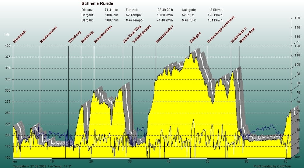
Schöne Rundtour mit Start in Eibelstadt.
Über Randersacker, Würzburg, hoch zur Steinburg, über den Schenkenturm spannend nach Veitshöcheim. In Zell steil zum Hettstadterhof. Auf schönen Trails über Waldbüttelbrunn, Eisingen, Kist, Reichnenberg zum Steinbachtal. Mit Highspeed nach Eibelstadt.
Carte du tour et altitude
Minimum height 77 m
Maximum height 376 m
Commentaires

Start in Eibelstadt oder längs der Strecke.
Tracks GPS
Trackpoints-
GPX / Garmin Map Source (gpx) download
-
TCX / Garmin Training Center® (tcx) download
-
CRS / Garmin Training Center® (crs) download
-
Google Earth (kml) download
-
G7ToWin (g7t) download
-
TTQV (trk) download
-
Overlay (ovl) download
-
Fugawi (txt) download
-
Kompass (DAV) Track (tk) download
-
Feuille de tours (pdf) download
-
Original file of the author (gpx) download
Add to my favorites
Remove from my favorites
Edit tags
Open track
My score
Rate

