Login

Login oublié ?

Cookies have to be accepted!
Your browser's cookie functionality is disabled. Please enable this functionality.

Not a member yet?

Register now
Login

Available for registred users only

Log in to use this feature.

Login oublié ?

Cookies have to be accepted!
Your browser's cookie functionality is disabled. Please enable this functionality.

Not a member yet?

Register now
Filter
Catégories
Advanced filters
  • Longueur (km)
  • Altimètre
Enregistrer le filtre Reset filter

TrackRank

QRCode

Technical data

Longueur11,5 km Altimètre684 m Way down631 m Durée04:00 h:m Date05.10.2008
Evaluations Author User Paysage Aspect amusement Condition Technique

Statistiques

2888 Vues 1 Evaluation 369 Téléchargements 3.00 Moyenne
Rate
  • Feuille de tours
  • Arrivée
  • Téléchargements
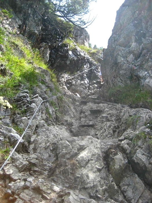
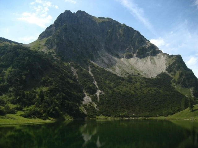
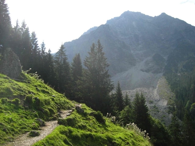
Von Reichenbach durch den Tobel zum Gailalpsee. Im Abstieg gemütliche Einkehr in der Gaisalpe

Galerie du tour

Carte du tour et altitude

  • Open Street Map
  • Google
Minimum height 845 m Maximum height 1524 m Vue de détail

More about the tour author

msdetroit
Member since 2007

Send private message

Commentaires

dancegirl70 on 13.07.2016

Sehr schöne Landschaft

Die Höhenmeterangabe stimmte leider gar nicht. Es waren nur 308HM und somit habe ich auch nur reine Gehzeit zweieinhalb Stunden gebraucht. Das hat mich doch enttäuscht. Man hat jedoch wenn man es vor ab weiß gute Möglichkeiten die Tour auszuweiten. Ab dem See geht es noch weiter aufwärts. Ansonsten ist es eben eine nette Halbtagestour passend zum Mittagessen auf der Hütte, die ja schon wieder dtl weit unten liegt.
Am Ausgangspunkt befindet sich ein Parkplatz, der allerdings am Wochenende bei gutem Wetter ziemlich voll war.

Tracks GPS

Trackpoints
  • GPX / Garmin Map Source (gpx) download
  • TCX / Garmin Training Center® (tcx) download
  • CRS / Garmin Training Center® (crs) download
  • Google Earth (kml) download
  • G7ToWin (g7t) download
  • TTQV (trk) download
  • Overlay (ovl) download
  • Fugawi (txt) download
  • Kompass (DAV) Track (tk) download
  • Feuille de tours (pdf) download
  • Original file of the author (gpx) download

More about the tour author

msdetroit
Member since 2007

Send private message
Share track
Add to my favorites
Remove from my favorites
Edit tags
My score
Rate
Tour: Gaisalpsee
Cat.: Randonnées
Longueur: 11,5 km
Evaluated on:
Durée:
Day(s)
Hour(s)
Minute(s)
Evaluation: Paysage Aspect amusement Condition Technique