Login

Login oublié ?

Cookies have to be accepted!
Your browser's cookie functionality is disabled. Please enable this functionality.

Not a member yet?

Register now
Login

Available for registred users only

Log in to use this feature.

Login oublié ?

Cookies have to be accepted!
Your browser's cookie functionality is disabled. Please enable this functionality.

Not a member yet?

Register now
Filter
Catégories
Advanced filters
  • Longueur (km)
  • Altimètre
Enregistrer le filtre Reset filter

TrackRank

QRCode

Technical data

Longueur40,0 km Altimètre1377 m Way down1369 m Durée03:04 h:m Date15.10.2008
Evaluations Author Paysage Aspect amusement Condition Technique

Statistiques

731 Vues Evaluations 177 Téléchargements Moyenne
Rate
  • Feuille de tours
  • Arrivée
  • Téléchargements

15.10.2008

Ondro :o)

Galerie du tour

Carte du tour et altitude

  • Open Street Map
  • Google
Minimum height 458 m Maximum height 1527 m Vue de détail

More about the tour author

tmax
Member since 2007

Send private message

Commentaires

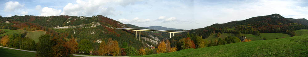
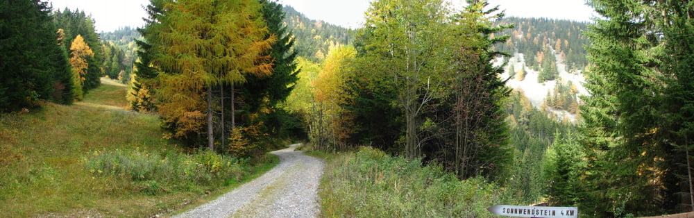
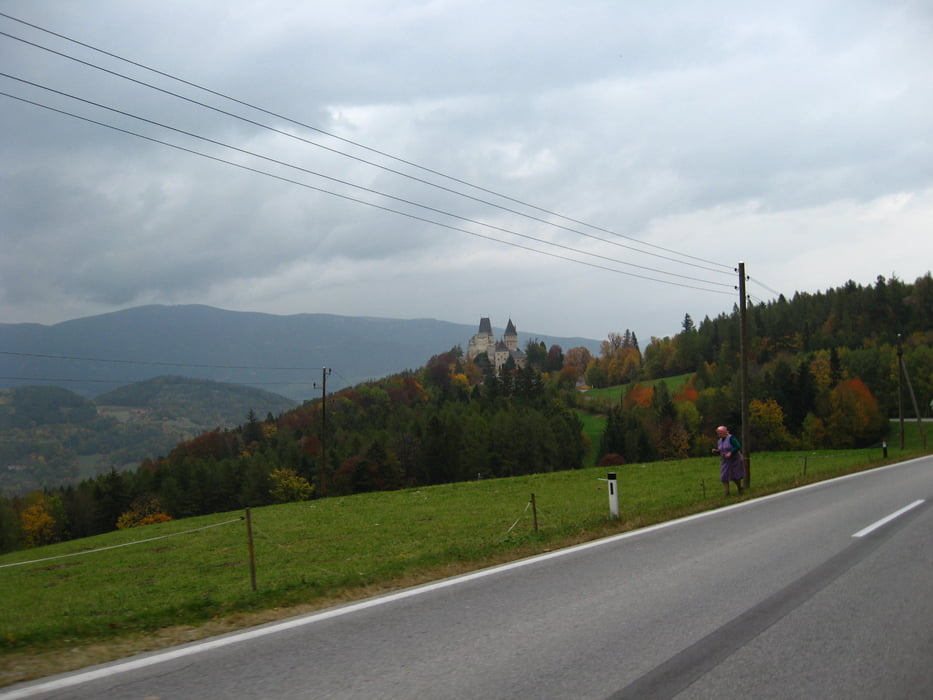
Gloggnitz - Auenbach - Weisenbach - Schottwien - Maria Schutz - Schwarzenberghutte - Sonnwendstein - Erzkogel -  Kummerbauerstadl - Baumgarten - Otterhal - Schlagl - Schloss Wartenstein - Gloggnitz

Tracks GPS

Trackpoints
  • GPX / Garmin Map Source (gpx) download
  • TCX / Garmin Training Center® (tcx) download
  • CRS / Garmin Training Center® (crs) download
  • Google Earth (kml) download
  • G7ToWin (g7t) download
  • TTQV (trk) download
  • Overlay (ovl) download
  • Fugawi (txt) download
  • Kompass (DAV) Track (tk) download
  • Feuille de tours (pdf) download
  • Original file of the author (gpx) download

More about the tour author

tmax
Member since 2007

Send private message
Share track
Add to my favorites
Remove from my favorites
Edit tags
My score
Rate
Tour: 20081015_Sonnwendstein
Cat.: Mountainbike
Longueur: 40,0 km
Evaluated on:
Durée:
Day(s)
Hour(s)
Minute(s)
Evaluation: Paysage Aspect amusement Condition Technique