Login

Login oublié ?

Cookies have to be accepted!
Your browser's cookie functionality is disabled. Please enable this functionality.

Not a member yet?

Register now
Login

Available for registred users only

Log in to use this feature.

Login oublié ?

Cookies have to be accepted!
Your browser's cookie functionality is disabled. Please enable this functionality.

Not a member yet?

Register now
Filter
Catégories
Advanced filters
  • Longueur (km)
  • Altimètre
Enregistrer le filtre Reset filter

TrackRank

QRCode

Technical data

Longueur72,9 km Altimètre711 m Way down717 m Durée03:10 h:m Date25.10.2008
Evaluations Author Paysage Aspect amusement Condition Technique

Statistiques

462 Vues 1 Evaluation 35 Téléchargements 4.00 Moyenne
Rate
  • Feuille de tours
  • Arrivée
  • Téléchargements

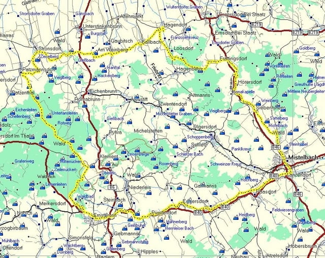
Große Runde mit MTB oder Treckingbike. Die Strecke führt auf Radwegen durch das nördliche, hügelige Weinviertel auf Routen des "Blauburgers und Silvaners-Radweg.

Je nach Gusto und Laune kann die Strecke als gemütliche Halbtagestour mit Einkehrmöglichkeiten gefahren werden.

Oder wer  es sportlicher haben will kann auch die Strecke am Stück in ca. 3:10 radeln.


Galerie du tour

Carte du tour et altitude

  • Open Street Map
  • Google
Minimum height 192 m Maximum height 432 m Vue de détail

More about the tour author

LeiseRadler
Member since 2008

Send private message

Commentaires

Start und Ziel in Ernstbrunn.

Tracks GPS

Trackpoints
  • GPX / Garmin Map Source (gpx) download
  • TCX / Garmin Training Center® (tcx) download
  • CRS / Garmin Training Center® (crs) download
  • Google Earth (kml) download
  • G7ToWin (g7t) download
  • TTQV (trk) download
  • Overlay (ovl) download
  • Fugawi (txt) download
  • Kompass (DAV) Track (tk) download
  • Feuille de tours (pdf) download
  • Original file of the author (gpx) download

More about the tour author

LeiseRadler
Member since 2008

Send private message
Share track
Add to my favorites
Remove from my favorites
Edit tags
My score
Rate
Tour: Ernstbrunn-Stronsdorf-Mistelbach
Cat.: Mountainbike
Longueur: 72,9 km
Evaluated on:
Durée:
Day(s)
Hour(s)
Minute(s)
Evaluation: Paysage Aspect amusement Condition Technique