Login

Login oublié ?

Cookies have to be accepted!
Your browser's cookie functionality is disabled. Please enable this functionality.

Not a member yet?

Register now
Login

Available for registred users only

Log in to use this feature.

Login oublié ?

Cookies have to be accepted!
Your browser's cookie functionality is disabled. Please enable this functionality.

Not a member yet?

Register now
Filter
Catégories
Advanced filters
  • Longueur (km)
  • Altimètre
Enregistrer le filtre Reset filter

TrackRank

QRCode

Technical data

Longueur59,4 km Altimètre562 m Way down560 m Durée05:00 h:m Date01.11.2008
Evaluations Author Paysage Aspect amusement Condition Technique

Statistiques

503 Vues Evaluations 107 Téléchargements Moyenne
Rate
  • Feuille de tours
  • Arrivée
  • Téléchargements
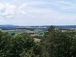
von Bamberg nach Baunach, hoch auf den Rennweg, rüber auf den Veitenstein (uphill als Schiebepassage im November) über Reckendorf und Baunach zurück nach Bamberg. Spaßtour

Carte du tour et altitude

  • Open Street Map
  • Google
Minimum height 228 m Maximum height 459 m Vue de détail

More about the tour author

Pitcairn
Member since 2008

Send private message

Commentaires

Tracks GPS

Trackpoints
  • GPX / Garmin Map Source (gpx) download
  • TCX / Garmin Training Center® (tcx) download
  • CRS / Garmin Training Center® (crs) download
  • Google Earth (kml) download
  • G7ToWin (g7t) download
  • TTQV (trk) download
  • Overlay (ovl) download
  • Fugawi (txt) download
  • Kompass (DAV) Track (tk) download
  • Feuille de tours (pdf) download
  • Original file of the author (gpx) download

More about the tour author

Pitcairn
Member since 2008

Send private message
Share track
Add to my favorites
Remove from my favorites
Edit tags
My score
Rate
Tour: über den Veitenstein
Cat.: Mountainbike
Longueur: 59,4 km
Evaluated on:
Durée:
Day(s)
Hour(s)
Minute(s)
Evaluation: Paysage Aspect amusement Condition Technique