


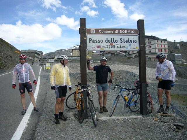
Tag 3 von 6 unserer 5 Ländertour. Heute führte es uns von La Punt aus über Zernez den Ofenpass und den Umbrailpass hinauf zum Passo dello Stelvio. Das Wetter spielte super mit, nicht zu heiß und oben auf 2.735 m nicht zu kalt. Grandiose Berge und Straßen, leider ca. 15 Km feiner Schotter auf dem Umbrailpass. Oben angekommen die große Entäuschung, über Nacht war durch den vielen Regen der Berg abgerutscht und hatte die Straße verschüttet. Gesperrt für zwei Tage war die Auskunft. Wir wollten so gerne die berühmten 48 Kehren fahren die man von vielen Bildern kennt. Räder in das Begleitfahrzeug geladen und damit zurück über Sta.Marie und dann nach Prad gefahren wo wir genächtigt haben.
Leider hat mein Collorado 300 die Höhe nicht richtig gemessen, die Starthöhe in La Punt betrug 1.694 m, Entschuldigung!!!
Galerie du tour


Carte du tour et altitude
Minimum height 2035 m
Maximum height 3315 m
More about the tour author
|
|
pinarello1 |
Commentaires

Tracks GPS
Trackpoints-
GPX / Garmin Map Source (gpx) download
-
TCX / Garmin Training Center® (tcx) download
-
CRS / Garmin Training Center® (crs) download
-
Google Earth (kml) download
-
G7ToWin (g7t) download
-
TTQV (trk) download
-
Overlay (ovl) download
-
Fugawi (txt) download
-
Kompass (DAV) Track (tk) download
-
Feuille de tours (pdf) download
-
Original file of the author (gpx) download
More about the tour author
|
|
pinarello1 |
Add to my favorites
Remove from my favorites
Edit tags
Open track
My score
Rate