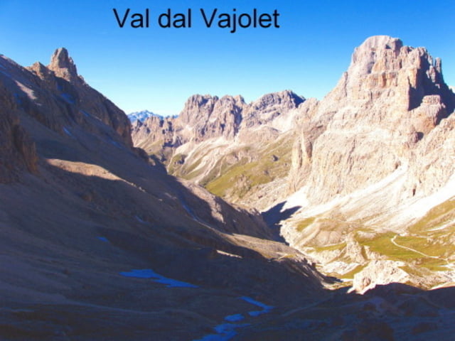
Itinerario su sentieri ben battuti dalla Val di Fassa in un ambiente di rocce dolomitiche da favola.Il percorso inizia da Gardeccia raggiungibile con navetta da Pera di Fassa (ore sette in poi costo 10 euro per andata-ritorno)
La prima parte di sentiero sino al rifugio Vajolet si mantiene sulla sinistra orografica per avere un grande panorama sul Catinaccio Rosengarden. E' anche possibile e più facile seguire gli ampi sentieri della destra orografica fino al rifugio Vajolet dove ci si ricongiunge alla traccia GPS. Dalla sinistra orografica però è possibile godere appieno del panorama verso Rosengarden e Vajolet.
Presso il passo Principe ove sorge l'omonimo rifugio ristrutturato al 2007, il tracciato punta verso il passo d'Antermoia (potete ammirare il Monolite sulle creste a sx del P.Principe) il sentiero poi scende e si dirige in ambiente roccioso verso il laghetto ed il rifugio Antermoia.
Dal rifugio Antermoia si scende nelle verdi vallate sottostanti dalle quali si scende per la Val di Udai sino a valle. Il tracciato GPS riporta al Park.
Dislivello complessivo 1075 mt. -sviluppo 16.7 km. - tempo di percorrenza ore 6.30 circa
Cartografia TABACCO GPS-UTM nr. 5 - Val Gardena-Alpe di Siusi 1:25000
Further information at
http://www.fassa.comGalerie du tour
Carte du tour et altitude
Commentaires

Tracks GPS
Trackpoints-
GPX / Garmin Map Source (gpx) download
-
TCX / Garmin Training Center® (tcx) download
-
CRS / Garmin Training Center® (crs) download
-
Google Earth (kml) download
-
G7ToWin (g7t) download
-
TTQV (trk) download
-
Overlay (ovl) download
-
Fugawi (txt) download
-
Kompass (DAV) Track (tk) download
-
Feuille de tours (pdf) download
-
Original file of the author (gpx) download


