Login

Login oublié ?

Cookies have to be accepted!
Your browser's cookie functionality is disabled. Please enable this functionality.

Not a member yet?

Register now
Login

Available for registred users only

Log in to use this feature.

Login oublié ?

Cookies have to be accepted!
Your browser's cookie functionality is disabled. Please enable this functionality.

Not a member yet?

Register now
Filter
Catégories
Advanced filters
  • Longueur (km)
  • Altimètre
Enregistrer le filtre Reset filter

TrackRank

QRCode

Technical data

Longueur15,3 km Altimètre916 m Way down911 m Durée06:00 h:m Date16.12.2008
Evaluations Author Paysage Aspect amusement Condition Technique

Statistiques

1472 Vues Evaluations 105 Téléchargements Moyenne
Rate
  • Feuille de tours
  • Arrivée
  • Téléchargements

E' un giro ad anello che inizia all'abitato di Contrin, vicino ad Arabba.

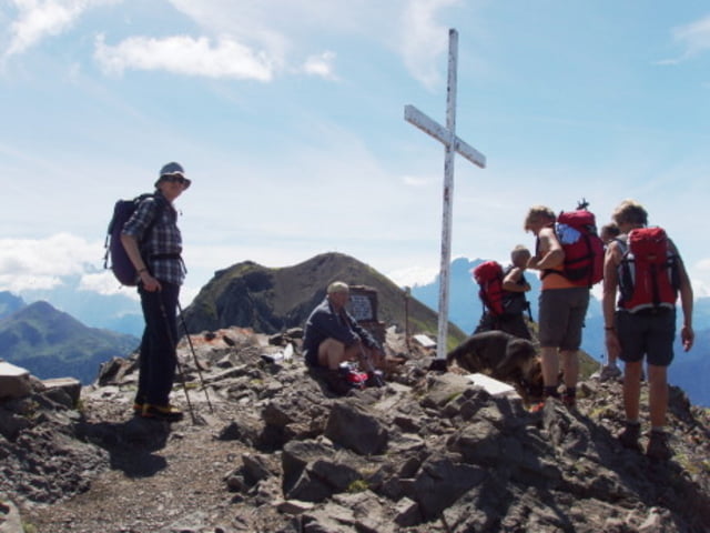
Dal piccolo parcheggio sulla strada si sale subito sul sentiero che si inoltra nel bosco (altro sentiero con segnaletica un km prima in un tornante senza possibilità di parcheggio) Si sale per bosco e per prati aperti sul sentiero segnato sino alla vetta del M.Sief -grandi trincee residue della prima guerra mondiale.

Si scende per la costa nord del M.Sief (Opere Militari della grande guerra) sino al Passo Sief e si prosegue verso la base dei Settsass.

Si costeggiano le rocce del Settsass per buon sentiero che porta ai prati di Pralongià.(impianti a fune) Da quì una stradina scende attraverso bellissimi prati sino alle malghe e da qui ancora all'abitato di Contrin

Further information at

http://www.dolomiti.org

Galerie du tour

Carte du tour et altitude

  • Open Street Map
  • Google
Minimum height 1658 m Maximum height 2432 m Vue de détail

More about the tour author

giangarzo
Member since 2008

Send private message

Commentaires

Tra Livinallongo del Col di Lana ed Arabba una strada si inerpica a nord verso l'abitato di Contrin. (Vi sono anche forti austriaci della Prima Guerra )

Tracks GPS

Trackpoints
  • GPX / Garmin Map Source (gpx) download
  • TCX / Garmin Training Center® (tcx) download
  • CRS / Garmin Training Center® (crs) download
  • Google Earth (kml) download
  • G7ToWin (g7t) download
  • TTQV (trk) download
  • Overlay (ovl) download
  • Fugawi (txt) download
  • Kompass (DAV) Track (tk) download
  • Feuille de tours (pdf) download
  • Original file of the author (gpx) download

More about the tour author

giangarzo
Member since 2008

Send private message
Share track
Add to my favorites
Remove from my favorites
Edit tags
My score
Rate
Tour: M.Sief-Settsass-Pralongià (Dolomiti)
Cat.: Tour en montagne
Longueur: 15,3 km
Evaluated on:
Durée:
Day(s)
Hour(s)
Minute(s)
Evaluation: Paysage Aspect amusement Condition Technique