


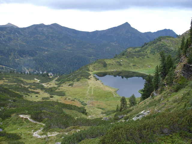
Man startet die Tour auf der Planneralm am Haus des Alpenvereins(N47 24.313 E14 12.023). Entlang der Lifttrasse geht es Hoch bis zum Plannersee, welcher schon zur Pause einlädt um die wunderschöne Gegend zu geniesen. Aber es geht weiter zum Plannerknot von wo aus man schon das Ziel in der Ferne erblicken kann. Der Hochröttelstein ist 2220m hoch. Als Variante kann man nun über die Seekoppe nach Oppenberg übergehen. Vom Gipfel aus sieht man die Hohe Trett, den Hochstein und das Mölbegg, sowie die Seekoppe und vieles mehr.
Further information at
http://www.gps-tour.info/tours/view.php/action.view/entity.detail/key.2978Galerie du tour
Carte du tour et altitude
Minimum height 1591 m
Maximum height 2224 m
More about the tour author

|
Commentaires

N47 24.313 E14 12.023
Tracks GPS
Trackpoints-
GPX / Garmin Map Source (gpx) download
-
TCX / Garmin Training Center® (tcx) download
-
CRS / Garmin Training Center® (crs) download
-
Google Earth (kml) download
-
G7ToWin (g7t) download
-
TTQV (trk) download
-
Overlay (ovl) download
-
Fugawi (txt) download
-
Kompass (DAV) Track (tk) download
-
Feuille de tours (pdf) download
More about the tour author
|
|
Add to my favorites
Remove from my favorites
Edit tags
Open track
My score
Rate