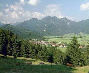
Die Tour beginnt in Eschenlohe (direkt an der kleinen Brücke im Zentrum), man fährt ca. 2 Km durch den Rest des Dorfes und dann rechts ab Richtung Bergsee. Schon nach wenigen Metern beginnt die recht anspruchsvolle Auffahrt, die eigentlich nur eine Erholungssphase (nach ca. 8 Km) hat. Nach ca. 1400 Metern begann das erste Schneefeld, das quer über den Waldweg ging, querfeldhoch konnten wir noch eine Kurve erklimmen, danach ging es dann in knöcheltiefen Schnee. Also wieder runter, nach 15 minütiger Abfahrt noch ca. 15 Kilometer durch das Eschenloher Tal, sehr schöne Strecke, mit kleinen Auf- und Abstiegen. Der erste Berg ist eine ideale Trainingsauffahrt, da man in ca. 2 Stunden ca. 1100 Hm inklusive Abfahrt absoliveren kann.
Further information at
http://www.mountainbike-in-bayern.deCarte du tour et altitude
Minimum height 654 m
Maximum height 1641 m
Commentaires

Tracks GPS
Trackpoints-
GPX / Garmin Map Source (gpx) download
-
TCX / Garmin Training Center® (tcx) download
-
CRS / Garmin Training Center® (crs) download
-
Google Earth (kml) download
-
G7ToWin (g7t) download
-
TTQV (trk) download
-
Overlay (ovl) download
-
Fugawi (txt) download
-
Kompass (DAV) Track (tk) download
-
Feuille de tours (pdf) download
-
Original file of the author (gpx) download
Add to my favorites
Remove from my favorites
Edit tags
Open track
My score
Rate

