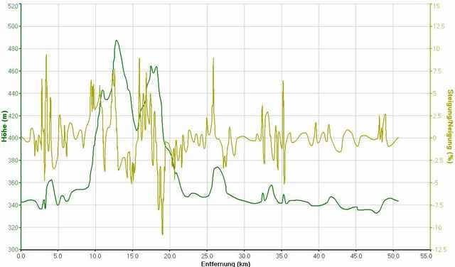
Trainingskurs, erste Hälfte mit gut 200 hm, die zweite Hälfte ist flach und sehr wenig befahren.
Dauer ca. 1h45 bei 29.5 km/h Schnitt.
Dauer ca. 1h45 bei 29.5 km/h Schnitt.
Carte du tour et altitude
Minimum height 333 m
Maximum height 487 m
Commentaires
Startpunkt ist der Rennplatz in Regensburg, Ecke Roter-Brach-Weg, Franz-Von-Taxis-Ring.
Tracks GPS
Trackpoints-
GPX / Garmin Map Source (gpx) download
-
TCX / Garmin Training Center® (tcx) download
-
CRS / Garmin Training Center® (crs) download
-
Google Earth (kml) download
-
G7ToWin (g7t) download
-
TTQV (trk) download
-
Overlay (ovl) download
-
Fugawi (txt) download
-
Kompass (DAV) Track (tk) download
-
Feuille de tours (pdf) download
-
Original file of the author (gpx) download
Add to my favorites
Remove from my favorites
Edit tags
Open track
My score
Rate


Danke
danke für die Tour :) Bin sie heute gefahren und hatte leider kurz vor Kehlheim einen schönen Sommer-Platzregen...
Scheinst gleich bei mir um die Ecke zu wohnen, da wir den gleichen Startpunkt der Tour haben ;)
Gruß, Alex