

die Anfahrt von Maspalomas mit dem Auto dauert ca eine halbe Stunde. Wir starten von einem kleinen Parkplatz an einer Strßenkreuzung (N 2750.456, W1539.061).
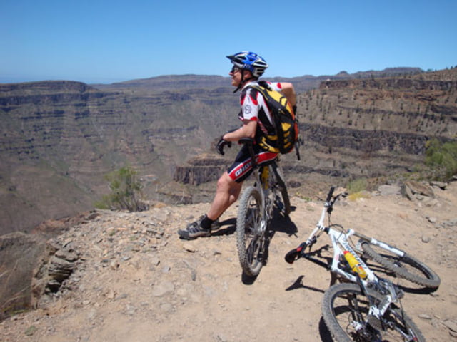
Von hier geht es auf einer Asphaltstraße bergauf bis der Asphalt endet. Von hier weg geht ein wunderschöner Feldweg ab der den Berg umrundet. Am Ende der Steigung wird es recht steil aber danach hab man einen wunderbaren Ausblick über den gesamten Süden der Insel.
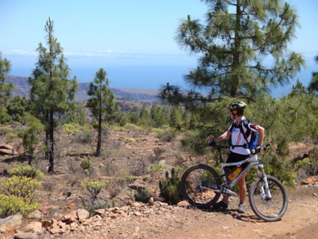
Dann folgt ein rezent planierter Feldweg der gelegentlich in einen Singletrail übergeht. Am Ende wechselt die Natur noch einmal völlig ihr Aussehen, dann endet die Runde und man ist wieder an der Asphaltstr. angelangt.
Galerie du tour
Carte du tour et altitude
Minimum height 594 m
Maximum height 1194 m
More about the tour author

|
ghostrider36 |
Commentaires

von Maspalomas zuerst auf der Autobahn dann auf der immer kleiner werdenden Straße nach Norden. Nr.: ?
Tracks GPS
Trackpoints-
GPX / Garmin Map Source (gpx) download
-
TCX / Garmin Training Center® (tcx) download
-
CRS / Garmin Training Center® (crs) download
-
Google Earth (kml) download
-
G7ToWin (g7t) download
-
TTQV (trk) download
-
Overlay (ovl) download
-
Fugawi (txt) download
-
Kompass (DAV) Track (tk) download
-
Feuille de tours (pdf) download
-
Original file of the author (gpx) download
More about the tour author
|
|
ghostrider36 |
Add to my favorites
Remove from my favorites
Edit tags
Open track
My score
Rate