Login

Login oublié ?

Cookies have to be accepted!
Your browser's cookie functionality is disabled. Please enable this functionality.

Not a member yet?

Register now
Login

Available for registred users only

Log in to use this feature.

Login oublié ?

Cookies have to be accepted!
Your browser's cookie functionality is disabled. Please enable this functionality.

Not a member yet?

Register now
Filter
Catégories
Advanced filters
  • Longueur (km)
  • Altimètre
Enregistrer le filtre Reset filter

TrackRank

QRCode

Technical data

Longueur3,5 km Altimètre166 m Way down147 m Durée03:00 h:m Date21.05.2009
Evaluations Author Paysage Aspect amusement Condition Technique

Statistiques

2944 Vues Evaluations 199 Téléchargements Moyenne
Rate
  • Feuille de tours
  • Arrivée
  • Téléchargements
Als Teils des "Oberlandsteig" ist es eine tolle Übung für Anfänger. Der Klettersteig führt meist auf Stiften am senkrechten Fels entlang 
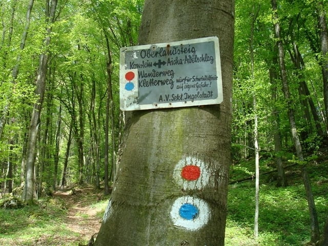
Vom Ausgangspunkt in Aicha ist der Weg blau bzw. rot/blau markiert.

Further information at

http://www.4funweb.de/altm/altm-olst.htm

Galerie du tour

Carte du tour et altitude

  • Open Street Map
  • Google
Minimum height 376 m Maximum height 473 m Vue de détail

More about the tour author

fkai
Member since 2008

Send private message

Commentaires

Tracks GPS

Trackpoints
  • GPX / Garmin Map Source (gpx) download
  • TCX / Garmin Training Center® (tcx) download
  • CRS / Garmin Training Center® (crs) download
  • Google Earth (kml) download
  • G7ToWin (g7t) download
  • TTQV (trk) download
  • Overlay (ovl) download
  • Fugawi (txt) download
  • Kompass (DAV) Track (tk) download
  • Feuille de tours (pdf) download
  • Original file of the author (gpx) download

More about the tour author

fkai
Member since 2008

Send private message
Share track
Add to my favorites
Remove from my favorites
Edit tags
My score
Rate
Tour: Konstein Klettersteig
Cat.: Sentier d’escalade
Longueur: 3,5 km
Evaluated on:
Durée:
Day(s)
Hour(s)
Minute(s)
Evaluation: Paysage Aspect amusement Condition Technique