Login

Login oublié ?

Cookies have to be accepted!
Your browser's cookie functionality is disabled. Please enable this functionality.

Not a member yet?

Register now
Login

Available for registred users only

Log in to use this feature.

Login oublié ?

Cookies have to be accepted!
Your browser's cookie functionality is disabled. Please enable this functionality.

Not a member yet?

Register now
Filter
Catégories
Advanced filters
  • Longueur (km)
  • Altimètre
Enregistrer le filtre Reset filter

TrackRank

QRCode

Technical data

Longueur17,3 km Altimètre345 m Way down22 m Durée01:00 h:m Date23.05.2009
Evaluations Author Paysage Aspect amusement Condition Technique

Statistiques

649 Vues Evaluations 16 Téléchargements Moyenne
Rate
  • Feuille de tours
  • Arrivée
  • Téléchargements

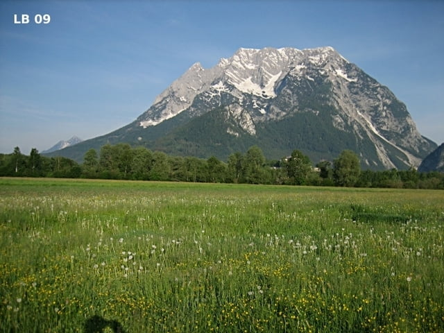
Die für MTB und Rennräder geeignete Radtour von Irdning nach Donnersbachwald ist auch die Anbindung der Mountainbiketouren in Donnersbachwald an den Ennstalradweg und die Alpentour Austria. Nur kurz nach Donnersbach und vor Donnersbachwald gibt es zwei kurze leichte Steigungen. Insgesamt eine leichte und landschaftlich sehr schöne Radtour.

Weitere Infos und Fotos findest du auf

biketours4you.at

Carte du tour et altitude

  • Open Street Map
  • Google
Minimum height 644 m Maximum height 969 m Vue de détail

More about the tour author

Trek1400d
Member since 2008

Send private message

Commentaires

Tracks GPS

Trackpoints
  • GPX / Garmin Map Source (gpx) download
  • TCX / Garmin Training Center® (tcx) download
  • CRS / Garmin Training Center® (crs) download
  • Google Earth (kml) download
  • G7ToWin (g7t) download
  • TTQV (trk) download
  • Overlay (ovl) download
  • Fugawi (txt) download
  • Kompass (DAV) Track (tk) download
  • Feuille de tours (pdf) download
  • Original file of the author (gpx) download

More about the tour author

Trek1400d
Member since 2008

Send private message
Share track
Add to my favorites
Remove from my favorites
Edit tags
My score
Rate
Tour: Irdning Donnersbachwald
Cat.: Vélo de course
Longueur: 17,3 km
Evaluated on:
Durée:
Day(s)
Hour(s)
Minute(s)
Evaluation: Paysage Aspect amusement Condition Technique