


24.05.2009 | Rundweg - Frankenbach
… Richen ...
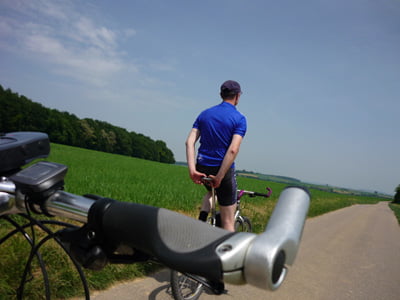
Heute am Sonntag, ging es zu zweit bei sehr schönem Wetter,
in einem Rundkurs (Schneckenweg) in Richtung Richen.
(Fürfeld, ..., Ittlingen, ..., Eppingen, ..., Gemmingen, ... ... ... ...)
Bei Speis & Trank in der Toskana, habe wir uns dann für den
restlichen Rückweg noch einmal richtig gestärkt (Schinkenbrot ...).
http://www.toskana-gemmingen.de
Die Strecke verläuft durchweg auf befestigten Wegen.
- Kraichgau-Radweg
- Waldweg (Rutschgefahr)
- Hauptstraße
Viel Spaß beim radeln
Schneckenweg ... der Weg ist das Ziel --- kleiner Insider ;-)
PS:
... die Dauer (hh:mm) zeigt die reine Fahrzeit an, laut GPS & Bike-Tacho.
... die technischen Daten stammen aus der Track-Datei (gpx).
Further information at
http://www.awrhome.deGalerie du tour
Carte du tour et altitude
Minimum height 147 m
Maximum height 264 m
More about the tour author
|
|
AWRHN75 |
Commentaires

Parkmöglichkeiten sind an folgenden Punkten ausreichend
vorhanden und von dort kann dann die Tour auch begonnen werden.
N49 09.826 E9 10.600 – Lidl Parkplatz
N49 09.812 E9 10.782 – Sportivo Parkplatz
Tracks GPS
Trackpoints-
GPX / Garmin Map Source (gpx) download
-
TCX / Garmin Training Center® (tcx) download
-
CRS / Garmin Training Center® (crs) download
-
Google Earth (kml) download
-
G7ToWin (g7t) download
-
TTQV (trk) download
-
Overlay (ovl) download
-
Fugawi (txt) download
-
Kompass (DAV) Track (tk) download
-
Feuille de tours (pdf) download
-
Original file of the author (gpx) download
More about the tour author
|
|
AWRHN75 |
Add to my favorites
Remove from my favorites
Edit tags
Open track
My score
Rate