Further information at
http://www.biketreff-niefern.deGalerie du tour
Carte du tour et altitude
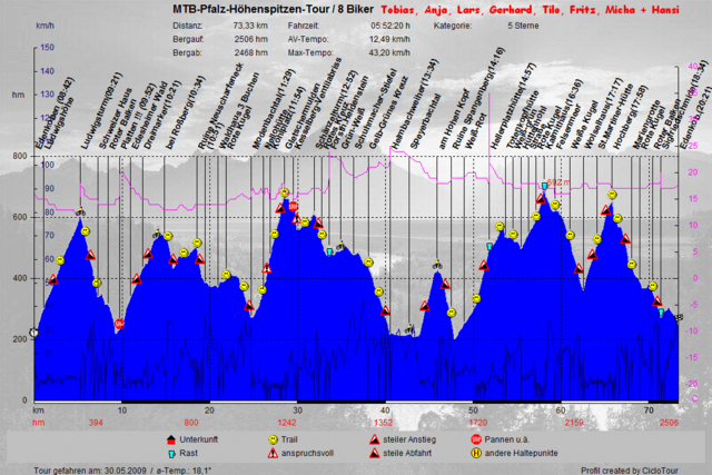
Minimum height 119 m
Maximum height 686 m
Commentaires
Tracks GPS
Trackpoints-
GPX / Garmin Map Source (gpx) download
-
TCX / Garmin Training Center® (tcx) download
-
CRS / Garmin Training Center® (crs) download
-
Google Earth (kml) download
-
G7ToWin (g7t) download
-
TTQV (trk) download
-
Overlay (ovl) download
-
Fugawi (txt) download
-
Kompass (DAV) Track (tk) download
-
Feuille de tours (pdf) download
-
Original file of the author (gpx) download
Add to my favorites
Remove from my favorites
Edit tags
Open track
My score
Rate


Edenkoben Trail Tour
Bei mir waren es auf beiden Geräten fast 2600 hm (Garmin Oregon 450 und Sigma Rox.)
Danke an der Ersteller...