Login

Login oublié ?

Cookies have to be accepted!
Your browser's cookie functionality is disabled. Please enable this functionality.

Not a member yet?

Register now
Login

Available for registred users only

Log in to use this feature.

Login oublié ?

Cookies have to be accepted!
Your browser's cookie functionality is disabled. Please enable this functionality.

Not a member yet?

Register now
Filter
Catégories
Advanced filters
  • Longueur (km)
  • Altimètre
Enregistrer le filtre Reset filter

TrackRank

QRCode

Technical data

Longueur22,8 km Altimètre443 m Way down278 m Durée01:30 h:m Date14.06.2009
Evaluations Author Paysage Aspect amusement Condition Technique

Statistiques

1532 Vues Evaluations 134 Téléchargements Moyenne
Rate
  • Feuille de tours
  • Arrivée
  • Téléchargements

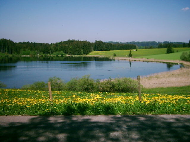
Landschaftliche tolle Rundtour mit Super Bademöglichkeiten.

Meist Wirtschaftswege ohne Verkehr, teilweise geschotterter Feldweg nur wenig rauhe Wege.

Vom Bahnhof Pfronten (Parken) über Pfronten Rehbichel, Oberdolden zum Kögelweiher und dann zum Attlesee. Zurück über Eisenberg und Holz nach Pfronten.

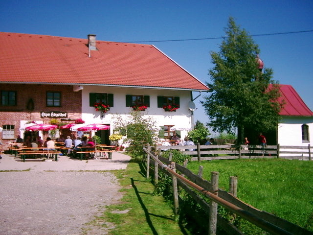
Einkehrmöglichkeit im Kögelhof.

Galerie du tour

Carte du tour et altitude

  • Open Street Map
  • Google
Minimum height 693 m Maximum height 938 m Vue de détail

More about the tour author

Hofstadt
Member since 2008

Send private message

Commentaires


Vom Ortseingang Pfronten in Richtung Bahnhof.

Am Bahnhof Pfronten gibt es viele Parkmöglichkeiten.

Tracks GPS

Trackpoints
  • GPX / Garmin Map Source (gpx) download
  • TCX / Garmin Training Center® (tcx) download
  • CRS / Garmin Training Center® (crs) download
  • Google Earth (kml) download
  • G7ToWin (g7t) download
  • TTQV (trk) download
  • Overlay (ovl) download
  • Fugawi (txt) download
  • Kompass (DAV) Track (tk) download
  • Feuille de tours (pdf) download
  • Original file of the author (gpx) download

More about the tour author

Hofstadt
Member since 2008

Send private message
Share track
Add to my favorites
Remove from my favorites
Edit tags
My score
Rate
Tour: Von Pfronten zum Attleweiher
Cat.: Trekkingbike
Longueur: 22,8 km
Evaluated on:
Durée:
Day(s)
Hour(s)
Minute(s)
Evaluation: Paysage Aspect amusement Condition Technique