Login

Login oublié ?

Cookies have to be accepted!
Your browser's cookie functionality is disabled. Please enable this functionality.

Not a member yet?

Register now
Login

Available for registred users only

Log in to use this feature.

Login oublié ?

Cookies have to be accepted!
Your browser's cookie functionality is disabled. Please enable this functionality.

Not a member yet?

Register now
Filter
Catégories
Advanced filters
  • Longueur (km)
  • Altimètre
Enregistrer le filtre Reset filter

TrackRank

QRCode

Technical data

Longueur2,5 km Altimètre0 m Way down637 m Durée02:00 h:m Date15.06.2009
Evaluations Author Paysage Aspect amusement Condition Technique

Statistiques

1262 Vues Evaluations 174 Téléchargements Moyenne
Rate
  • Feuille de tours
  • Arrivée
  • Téléchargements

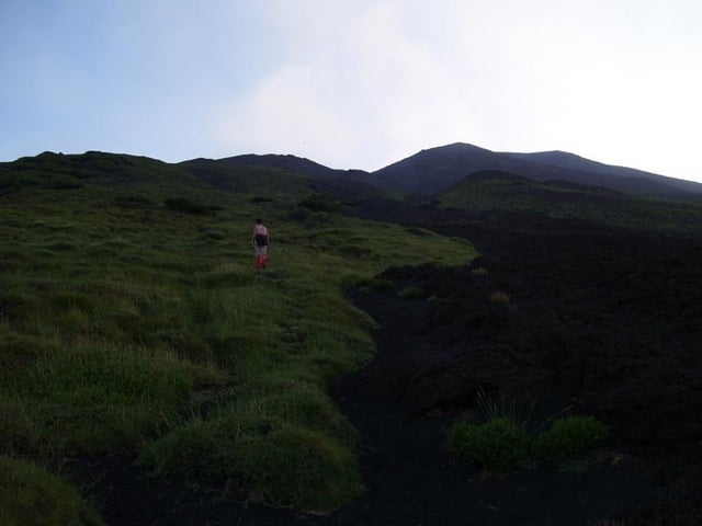
Hike from the Rif.Citelli to a lookout-point to the Valle del Bove. We used this to see Red Lava in the late evening / night.

There is no footpath, but more or less steep sandy straight uphill walking.

Because there is no footpath, it can be difficult to find down in the night, even with flashlights and a GPS.

Galerie du tour

Carte du tour et altitude

  • Open Street Map
  • Google
Minimum height 1718 m Maximum height 2365 m Vue de détail

More about the tour author

hans-lauber
Member since 2009

Send private message

Commentaires

Starts at the Rifugio Citelli at the Etna Nord region

Tracks GPS

Trackpoints
  • GPX / Garmin Map Source (gpx) download
  • TCX / Garmin Training Center® (tcx) download
  • CRS / Garmin Training Center® (crs) download
  • Google Earth (kml) download
  • G7ToWin (g7t) download
  • TTQV (trk) download
  • Overlay (ovl) download
  • Fugawi (txt) download
  • Kompass (DAV) Track (tk) download
  • Feuille de tours (pdf) download
  • Original file of the author (gpx) download

More about the tour author

hans-lauber
Member since 2009

Send private message
Share track
Add to my favorites
Remove from my favorites
Edit tags
My score
Rate
Tour: Etna: Rif.Citelli - Lookout to Valle del Bove
Cat.: Randonnées
Longueur: 2,5 km
Evaluated on:
Durée:
Day(s)
Hour(s)
Minute(s)
Evaluation: Paysage Aspect amusement Condition Technique