Login

Login oublié ?

Cookies have to be accepted!
Your browser's cookie functionality is disabled. Please enable this functionality.

Not a member yet?

Register now
Login

Available for registred users only

Log in to use this feature.

Login oublié ?

Cookies have to be accepted!
Your browser's cookie functionality is disabled. Please enable this functionality.

Not a member yet?

Register now
Filter
Catégories
Advanced filters
  • Longueur (km)
  • Altimètre
Enregistrer le filtre Reset filter

TrackRank

QRCode

Technical data

Longueur4,1 km Altimètre873 m Way down10 m Durée02:30 h:m Date16.06.2009
Evaluations Author Paysage Aspect amusement Condition Technique

Statistiques

1726 Vues 1 Evaluation 188 Téléchargements 5.00 Moyenne
Rate
  • Feuille de tours
  • Arrivée
  • Téléchargements

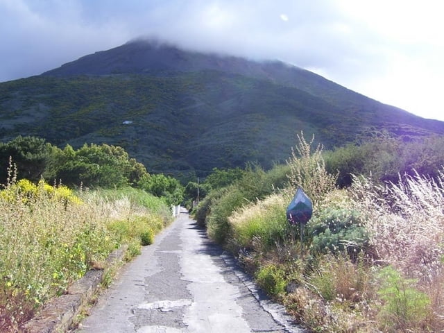
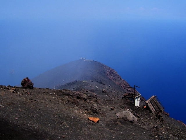
Aufstieg von Stomboli-Ort zum höchsten Punkt am Krater. (Ist nicht der höchste Punkt der Insel)

Von den Schutzständen am Grat lassen sich die Eruptionen - vor allem bei Nacht - gut beobachten.

Technisch unschwierig, mit festen Turnschuhen begehbar, aber die Gefahren des Vulkans beachten: Eruptionen, Schwefelgase, Sturm, Sandsturm, Hitze, Kälte, Verirren im Nebel...

Aufstieg soll ohne Führer angeblich verboten sein.

Unbedingt mitnehmen pro Person:

1l Wasser, (Am besten: Taucher-)Brille gegen Sand, Pullover(auch wenn's unten noch so heiß ist), winddichte Kleidung, Mütze, Handschuhe, Taschenlampe. Man muss unter Umständen mehr als 1 Stunde auf einen Ausbruch warten, dabei wird's im Sturm sehr schnell kalt. Ev. Schlafsack mitbringen! Übernachten ist definitiv verboten.

Galerie du tour

Carte du tour et altitude

  • Open Street Map
  • Google
Minimum height 47 m Maximum height 923 m Vue de détail

More about the tour author

hans-lauber
Member since 2009

Send private message

Commentaires

japa-fi on 22.08.2014

Must see

If you can handle the ascent, then I recommend taking this tour. It's not that often one can get on top of active volcano at sunset to enjoy the views. Unfortunately for me, the volcano was having a less active period, but still experience to remember.
Von der Kirche geht östlich gleich neben einer Apotheke ein Weg los. Zum Gipfel nicht beschildert.

Tracks GPS

Trackpoints
  • GPX / Garmin Map Source (gpx) download
  • TCX / Garmin Training Center® (tcx) download
  • CRS / Garmin Training Center® (crs) download
  • Google Earth (kml) download
  • G7ToWin (g7t) download
  • TTQV (trk) download
  • Overlay (ovl) download
  • Fugawi (txt) download
  • Kompass (DAV) Track (tk) download
  • Feuille de tours (pdf) download
  • Original file of the author (gpx) download

More about the tour author

hans-lauber
Member since 2009

Send private message
Share track
Add to my favorites
Remove from my favorites
Edit tags
My score
Rate
Tour: Stromboli Aufstieg
Cat.: Randonnées
Longueur: 4,1 km
Evaluated on:
Durée:
Day(s)
Hour(s)
Minute(s)
Evaluation: Paysage Aspect amusement Condition Technique