


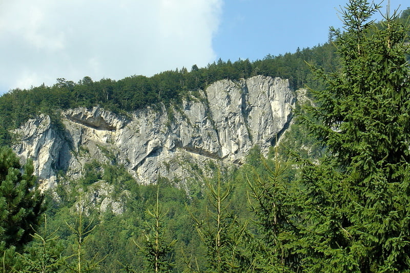
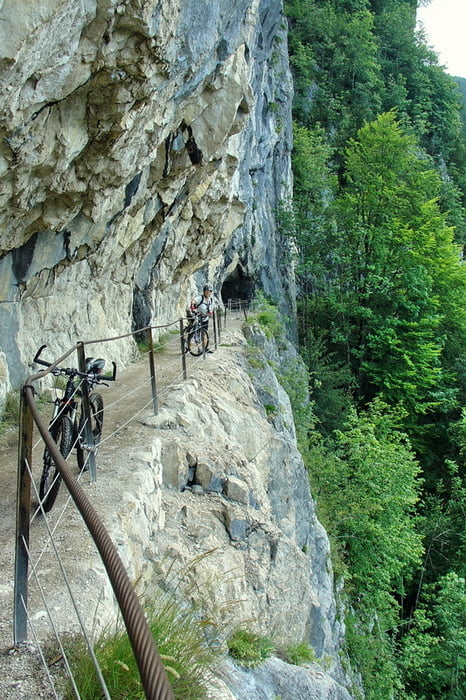
Will man sich den asphaltierten Anstieg von Goisern aus sparen, fährt man bis zum Berghotel Predigstuhl mit dem Auto. Die Strecke bis zur Ewigen Wand ist Teil der WM Strecke. Derzeit durch den Starkregen sehr ausgeschwemmt und rutschig. Bergab nicht das grosse Problem. Der Rückweg ist allerdings etwas anstregend. Wir sind vom Berghotel bis zur Ewigen Wand und dann die selbe Strecke wieder zurück. Anschliessend immer links Richtung Roßmoosalm bzw. Perneck. Ab Roßmoosalm wird es wieder etwas beschwerlich und steil (18 %) und unterhalb der Zwerchwand muss man das Bike tragen (ca. 400 m). An und für sich ist dies der Wanderweg. Man wird jedoch mit traumhaften Aussichten belohnt.
Angekommen bei der Hütteneckalm (1240 müA) besteht die Möglichkeit zur Einkehr (sensationelle Speckbrote und Kaiserschmarrn). Von dort aus geht's nur mehr bergab, wobei das erste Stück schon etwas steil ist.
Bei der zweiten Abbiegung (1047 mÜA) geht's dann Richtung Kriemoos bei traumhafter Aussicht zurück zum Parkplatz. Im Winter ist hier eine Langlaufloipe.
Eine nette kurze Tour mit sensationellen Ausblicken die teilweise doch auch etwas fordert wenn's nass ist.
Further information at
http://www.tiscover.com/at/guide/5,de,SCH1/objectId,CTR116235at,parentId,RGN20at,season,at1,selectedEntry,catering/intern.htmlGalerie du tour


Carte du tour et altitude
Minimum height 739 m
Maximum height 1255 m
More about the tour author
|
|
buchesie |
Commentaires

Goisern Zentrum Richtung Lasern und Berghotel Predigstuhl.
Tracks GPS
Trackpoints-
GPX / Garmin Map Source (gpx) download
-
TCX / Garmin Training Center® (tcx) download
-
CRS / Garmin Training Center® (crs) download
-
Google Earth (kml) download
-
G7ToWin (g7t) download
-
TTQV (trk) download
-
Overlay (ovl) download
-
Fugawi (txt) download
-
Kompass (DAV) Track (tk) download
-
Feuille de tours (pdf) download
-
Original file of the author (gpx) download
More about the tour author
|
|
buchesie |
Add to my favorites
Remove from my favorites
Edit tags
Open track
My score
Rate