


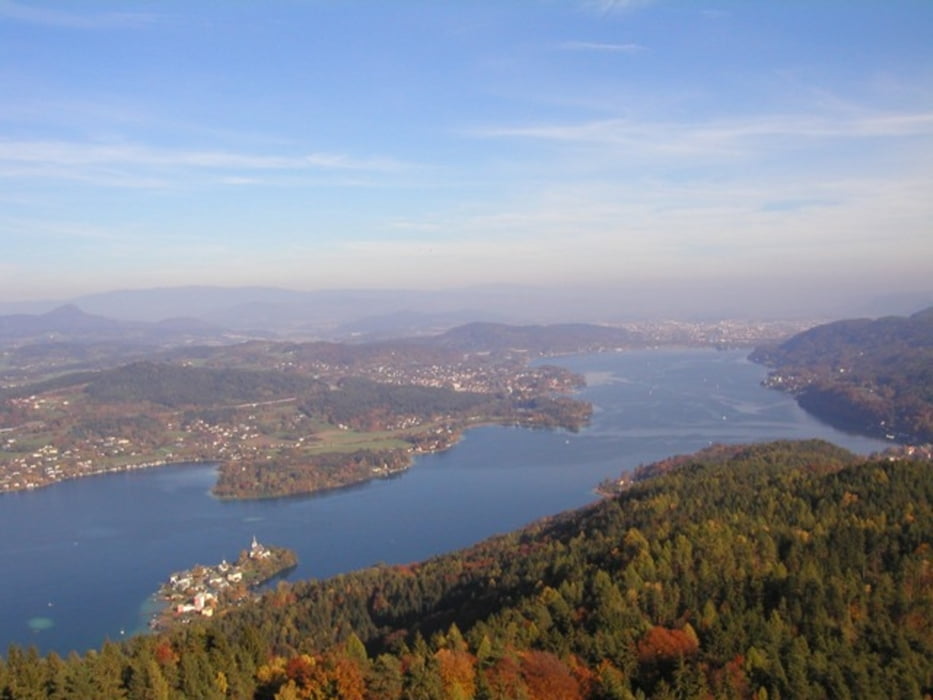
Schöne Tour durch den Höhenzug hinter Krumpendorf und Pörtschach.
Verlauf: Radweg R4 Richtung Klagenfurt bis Kropfitschbad, links über die Bahn auf B83 und in Richtung Wölfnitz - bei Gasthaus Jerolitsch links Richtung Drasing - nach links in den Wald und Bogen rund um den Hügel, Abfahrt Richtung Hohenfeld - Pirk. In Pirk rechts am Wörthersee-Panoramaweg bis Pirkerkogel - Abfahrt Richtung Sallach - rechtskníck aufwärts Richtung Pirk, danach auf kleinen Wegen in Richtung Kleiiner Gaisrücken - Abfahrt Richtung Prosintschach - rechts weg aufwärts auf Feldweg, am nächsten Fahrweg rechts nach Sallach, nach Autobahnunterführung links weg nach Pritschitz, nach krzer Steigung rechts durch Waldstück - Pritschitz durchqueren, weiter Richtung Weibrzahn und geradeaus nach Krumpendorf.
Further information at
http://www.woerthersee.com/de/theme/rad/genussrad/radtouren_allgemein.htmGalerie du tour

Carte du tour et altitude
Minimum height 440 m
Maximum height 666 m
More about the tour author
|
|
Roland Leschanz |
Commentaires

von Klagenfurt: B83 bis Krumoendorf. Parkplatz beim Parkbad in der Pamperlallee.
von Villach: A2 Abfahrt Krumpendorf, im Kreisverkehr links, beim Gemeindeamt rechts abbiegen, weiter bis zum Parkplatz des Parkbads.
Tracks GPS
Trackpoints-
GPX / Garmin Map Source (gpx) download
-
TCX / Garmin Training Center® (tcx) download
-
CRS / Garmin Training Center® (crs) download
-
Google Earth (kml) download
-
G7ToWin (g7t) download
-
TTQV (trk) download
-
Overlay (ovl) download
-
Fugawi (txt) download
-
Kompass (DAV) Track (tk) download
-
Feuille de tours (pdf) download
-
Original file of the author (gpx) download
More about the tour author
|
|
Roland Leschanz |
Add to my favorites
Remove from my favorites
Edit tags
Open track
My score
Rate