Login

Login oublié ?

Cookies have to be accepted!
Your browser's cookie functionality is disabled. Please enable this functionality.

Not a member yet?

Register now
Login

Available for registred users only

Log in to use this feature.

Login oublié ?

Cookies have to be accepted!
Your browser's cookie functionality is disabled. Please enable this functionality.

Not a member yet?

Register now
Filter
Catégories
Advanced filters
  • Longueur (km)
  • Altimètre
Enregistrer le filtre Reset filter

TrackRank

QRCode

Technical data

Longueur20,2 km Altimètre863 m Way down750 m Durée02:30 h:m Date26.12.2003
Evaluations Author User Paysage Aspect amusement Condition Technique

Statistiques

3080 Vues 6 Evaluations 593 Téléchargements 3.67 Moyenne
Rate
  • Feuille de tours
  • Arrivée
  • Téléchargements
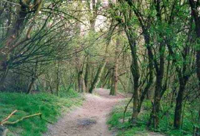
Eine weitere sehr empfehlenswerte Variante von der GIS über den Haselgraben zurüch nach Linz. Wir fahren hier schier endlos durch verlohrene Wälder und das direkt neben der Großstadt - herrlich.

Galerie du tour

Carte du tour et altitude

  • Open Street Map
  • Google
Minimum height 182 m Maximum height 874 m Vue de détail

More about the tour author

ingo
Member since 2001

Send private message

Commentaires

ure on 07.01.2004

genuss

das klingt nach einer schönen genuss tour.
bin wieder voll motiviert für den fürhling. klasse page und touren hier.
ciao ure

www.o-r-a-c.at
veste on 23.08.2004

fein

super runde! v.a. die abfahrten roquen :)))
stif83 on 04.09.2013

leider

konnte ich den Tourdaten nur bergauf folgen. Runter musste ich sehr improvisieren... Schade!
Beliebige Anfahrt auf die GIS wählen. Wir sind vom Toyota Händler direkt am Beginn des Haselgrabens auf die GIS gestartet.

Tracks GPS

Trackpoints
  • GPX / Garmin Map Source (gpx) download
  • TCX / Garmin Training Center® (tcx) download
  • CRS / Garmin Training Center® (crs) download
  • Google Earth (kml) download
  • G7ToWin (g7t) download
  • TTQV (trk) download
  • Overlay (ovl) download
  • Fugawi (txt) download
  • Kompass (DAV) Track (tk) download
  • Feuille de tours (pdf) download
  • Original file of the author (g7t) download

More about the tour author

ingo
Member since 2001

Send private message
Share track
Add to my favorites
Remove from my favorites
Edit tags
My score
Rate
Tour: GIS Haselgraben Variante
Cat.: Mountainbike
Longueur: 20,2 km
Evaluated on:
Durée:
Day(s)
Hour(s)
Minute(s)
Evaluation: Paysage Aspect amusement Condition Technique