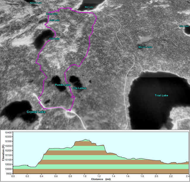
This is approximately half the Clyde Lake hike. Rather than hiking up to Clyde Lake it cuts across the south end of Wall Lake and back to the trailhead.
The hike begins slightly above 10,000 feet so if you're not used to the high elevation, be prepared to stop and catch your breath often.
The hike begins slightly above 10,000 feet so if you're not used to the high elevation, be prepared to stop and catch your breath often.
Carte du tour et altitude
Minimum height 3055 m
Maximum height 3146 m
Commentaires

Crystal Lake Trailhead.
Tracks GPS
Trackpoints-
GPX / Garmin Map Source (gpx) download
-
TCX / Garmin Training Center® (tcx) download
-
CRS / Garmin Training Center® (crs) download
-
Google Earth (kml) download
-
G7ToWin (g7t) download
-
TTQV (trk) download
-
Overlay (ovl) download
-
Fugawi (txt) download
-
Kompass (DAV) Track (tk) download
-
Feuille de tours (pdf) download
-
Original file of the author (gpx) download
Add to my favorites
Remove from my favorites
Edit tags
Open track
My score
Rate


