Login

Login oublié ?

Cookies have to be accepted!
Your browser's cookie functionality is disabled. Please enable this functionality.

Not a member yet?

Register now
Login

Available for registred users only

Log in to use this feature.

Login oublié ?

Cookies have to be accepted!
Your browser's cookie functionality is disabled. Please enable this functionality.

Not a member yet?

Register now
Filter
Catégories
Advanced filters
  • Longueur (km)
  • Altimètre
Enregistrer le filtre Reset filter

TrackRank

QRCode

Technical data

Longueur59,0 km Altimètre624 m Way down643 m Durée02:54 h:m Date12.09.2009
Evaluations Author Paysage Aspect amusement Condition Technique

Statistiques

972 Vues Evaluations 232 Téléchargements Moyenne
Rate
  • Feuille de tours
  • Arrivée
  • Téléchargements
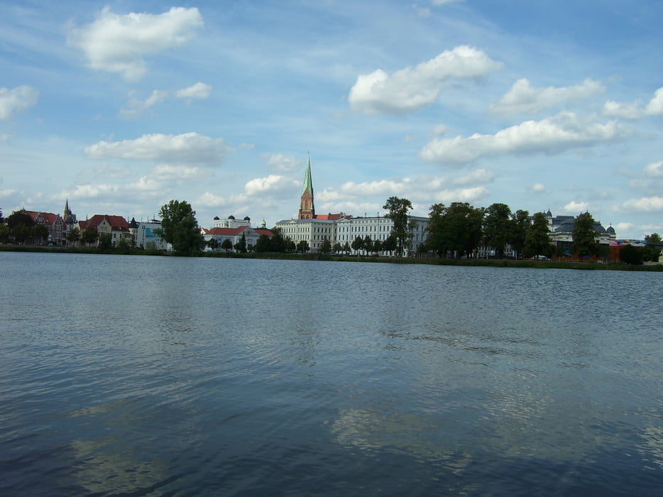
Sehr schöne Tour mit Blick auf den See und auch die schöne Stadt Schwerin.

Carte du tour et altitude

  • Open Street Map
  • Google
Minimum height 49 m Maximum height 140 m Vue de détail

More about the tour author

crohling
Member since 2009

Send private message

Commentaires

Von Norden über die A 14 nach Hohen Viecheln. Parkplätze im Ort und Start der Tour unmittelbar am See - traumhaft!

Tracks GPS

Trackpoints
  • GPX / Garmin Map Source (gpx) download
  • TCX / Garmin Training Center® (tcx) download
  • CRS / Garmin Training Center® (crs) download
  • Google Earth (kml) download
  • G7ToWin (g7t) download
  • TTQV (trk) download
  • Overlay (ovl) download
  • Fugawi (txt) download
  • Kompass (DAV) Track (tk) download
  • Feuille de tours (pdf) download
  • Original file of the author (gpx) download

More about the tour author

crohling
Member since 2009

Send private message
Share track
Add to my favorites
Remove from my favorites
Edit tags
My score
Rate
Tour: Rundfahrt Schweriner See
Cat.: Touring vélo
Longueur: 59,0 km
Evaluated on:
Durée:
Day(s)
Hour(s)
Minute(s)
Evaluation: Paysage Aspect amusement Condition Technique