Login

Login oublié ?

Cookies have to be accepted!
Your browser's cookie functionality is disabled. Please enable this functionality.

Not a member yet?

Register now
Login

Available for registred users only

Log in to use this feature.

Login oublié ?

Cookies have to be accepted!
Your browser's cookie functionality is disabled. Please enable this functionality.

Not a member yet?

Register now
Filter
Catégories
Advanced filters
  • Longueur (km)
  • Altimètre
Enregistrer le filtre Reset filter

TrackRank

QRCode

Technical data

Longueur22,3 km Altimètre166 m Way down152 m Durée01:05 h:m Date24.09.2009
Evaluations Author User Paysage Aspect amusement Condition Technique

Statistiques

234 Vues 1 Evaluation 24 Téléchargements 3.00 Moyenne
Rate
  • Feuille de tours
  • Arrivée
  • Téléchargements

Vom Friedhof von Martinstein über den Nahe Radweg zur Hermannshöhle, kleine Rast.

Zurück über einen Trampelpfad ( in der Hermannshöhle nachfragen)

Further information at

http://www.harfenmuehle.net

Galerie du tour

Carte du tour et altitude

  • Open Street Map
  • Google
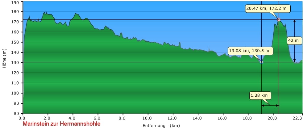
Minimum height 118 m Maximum height 179 m Vue de détail

More about the tour author

Koch
Member since 2008

Send private message

Commentaires

Martinstein über die Brücke zum Friedhof

Tracks GPS

Trackpoints
  • GPX / Garmin Map Source (gpx) download
  • TCX / Garmin Training Center® (tcx) download
  • CRS / Garmin Training Center® (crs) download
  • Google Earth (kml) download
  • G7ToWin (g7t) download
  • TTQV (trk) download
  • Overlay (ovl) download
  • Fugawi (txt) download
  • Kompass (DAV) Track (tk) download
  • Feuille de tours (pdf) download
  • Original file of the author (gpx) download

More about the tour author

Koch
Member since 2008

Send private message
Share track
Add to my favorites
Remove from my favorites
Edit tags
My score
Rate
Tour: Zur Hermannshöhle
Cat.: Trekkingbike
Longueur: 22,3 km
Evaluated on:
Durée:
Day(s)
Hour(s)
Minute(s)
Evaluation: Paysage Aspect amusement Condition Technique