

Von Laichingen gehts auf Feldwegen via Seissen an den "Albtrauf" oberhalb von Blaubeuren. Hier findet man nicht nur exzellente Kletterfelsen, sondern auch schöne Trails ins Tal der Blau. Untenangekommen fahren wir zum Blautopf, daran vorbei und auf einer fiesen Kies-Steige hoch nach Sonderbuch (wer es gemächlicher mag, muss die Strasse benutzen - die ist weniger steil).
Am Ortseingang biegen wir direkt wieder nach links in den Wald ein, wo uns eine Auswahl an Wegen und Trails zum Flow einlädt. Unser Flow führt uns zurück nach Blaubeuren zum Blautopf.
Tipp für warme, sonnige Tage: Eis-Bof in der Innenstadt. Lecker Eis!!
Von Blaubeuren aus fahren wir auf dem Radweg in Richtung Schelklingen. Zwischen Weiler und Schelklingen biegen wir rechts ab ins Tiefental, welches uns in gemächlicher Steigung nach Sontheim bringt.
Von hier aus auf Feld- und Radwegen zurück nach Laichingen.
(Bilder folgen...)
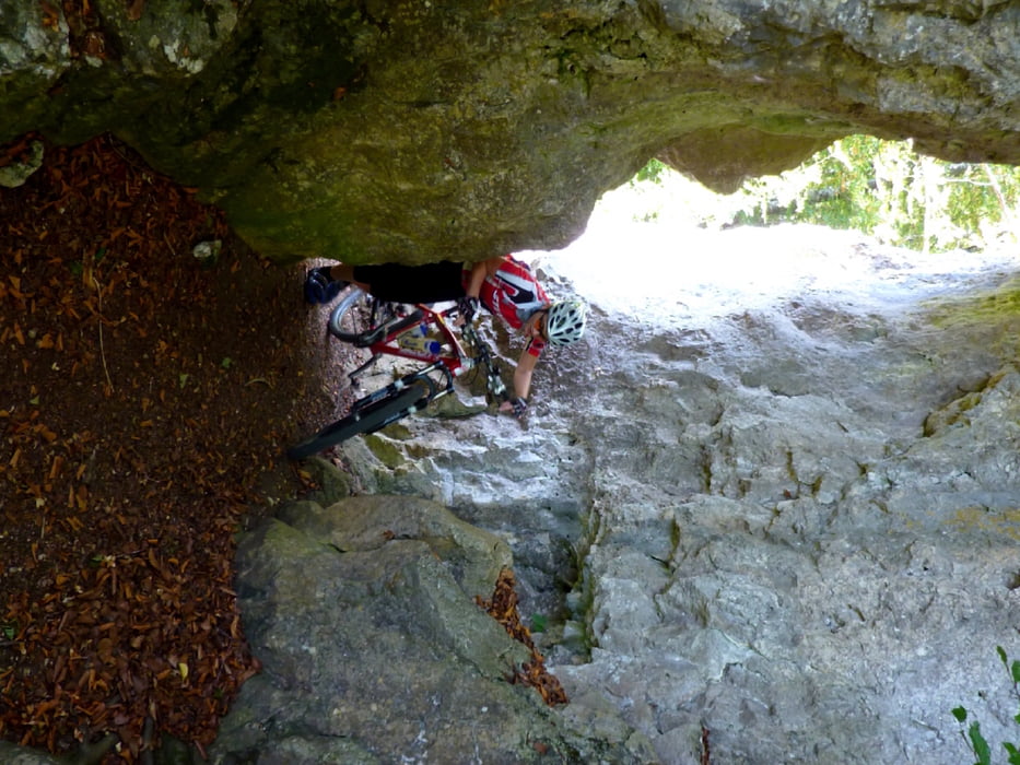
Galerie du tour


Carte du tour et altitude
Minimum height 1879 m
Maximum height 2135 m
More about the tour author
|
|
ckjh |
Commentaires

Gut erreichbar via B465/B28 und A8
Tracks GPS
Trackpoints-
GPX / Garmin Map Source (gpx) download
-
TCX / Garmin Training Center® (tcx) download
-
CRS / Garmin Training Center® (crs) download
-
Google Earth (kml) download
-
G7ToWin (g7t) download
-
TTQV (trk) download
-
Overlay (ovl) download
-
Fugawi (txt) download
-
Kompass (DAV) Track (tk) download
-
Feuille de tours (pdf) download
-
Original file of the author (gpx) download
More about the tour author
|
|
ckjh |
Add to my favorites
Remove from my favorites
Edit tags
Open track
My score
Rate