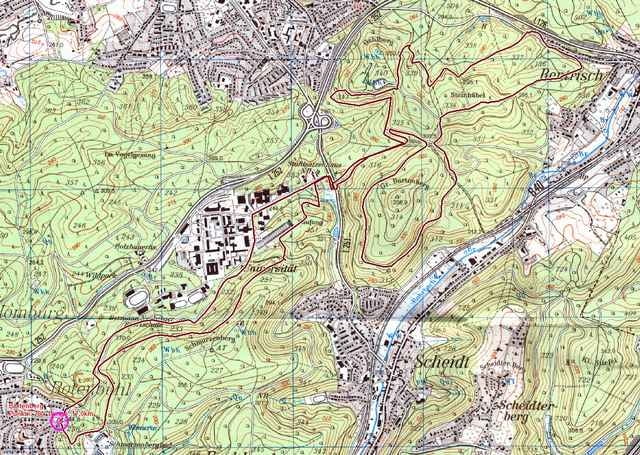
Kurze Trainingsrunde, schnell und knackig.
Carte du tour et altitude
Minimum height 254 m
Maximum height 352 m
Commentaires
Saarbrücken Scheidter Strasse bis zum Ende (Rotenbühel), am Kreisel parken
Tracks GPS
Trackpoints-
GPX / Garmin Map Source (gpx) download
-
TCX / Garmin Training Center® (tcx) download
-
CRS / Garmin Training Center® (crs) download
-
Google Earth (kml) download
-
G7ToWin (g7t) download
-
TTQV (trk) download
-
Overlay (ovl) download
-
Fugawi (txt) download
-
Kompass (DAV) Track (tk) download
-
Feuille de tours (pdf) download
-
Original file of the author (g7t) download
Add to my favorites
Remove from my favorites
Edit tags
Open track
My score
Rate


Kommentar zur Tour
Bin sie abends nach dem Feierabend gefahren und bin die letzten 30 minuten im dücklen gefahren (habe natürlich eine gute Licht ausrustung). Ich werde sie wieder fahren aber diesmal morgens und mit einem Freund.
Mit mehr Single Trails wäre die Tour noch besser.