

In Garmisch am Eisstadion gestartet hatte Reinhard gleich einen Kettenschaden, zurück in die Stadt zum "Bikebaron" der sofort geholfen hat. Anschließend wieder auf die Strecke und gleich die nächste Panne bei Franz (Hinterrad platt). Nach den ersten 3 Km kam die erste Schiebepassage die sich über 1 Km hinzog. Ab dort konnten wir die Strecke voll genießen. In Ehrwald führte uns die Route die Zugspitzstrasse hinauf als wir merkten das uns die Zeit davonläuft. Also wieder hinuntergefahren und die und schnellere Strecke bis nach Garmisch genommen. Eine schöne Tour, wunderbare Landschaft und wenig befahren.
Die angegebene Zeit ist brutto, die Nettozeit habe ich leider nicht da mein Hac4 ausgesetzt hat.
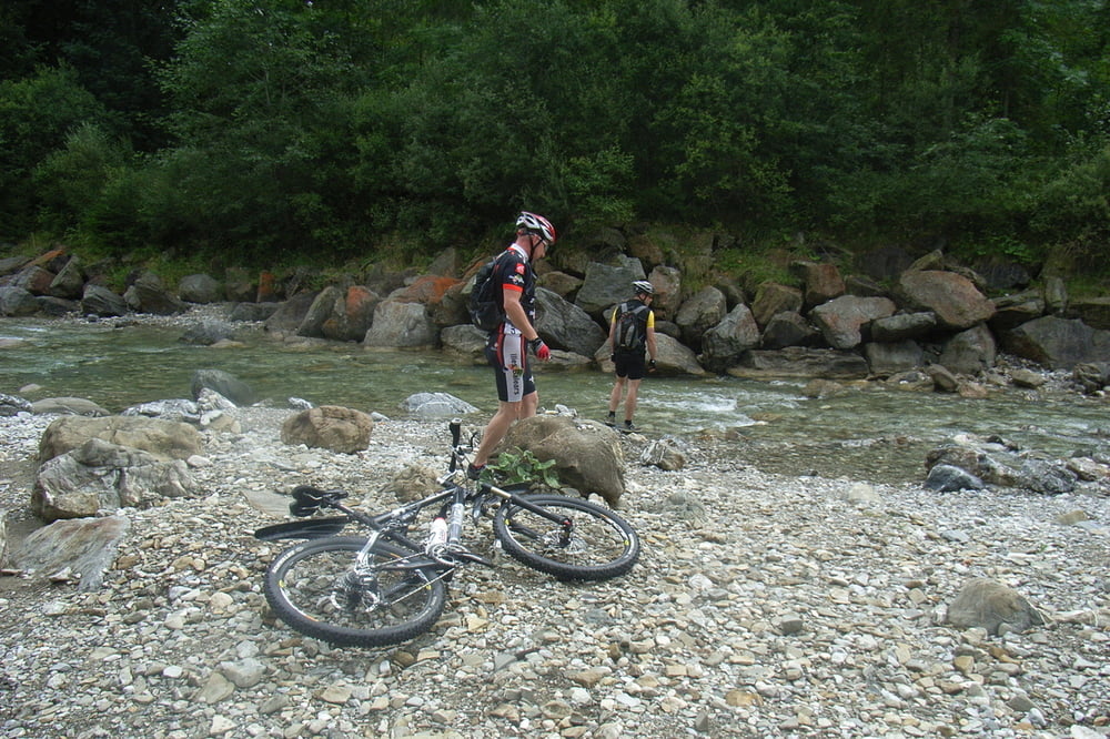
Galerie du tour


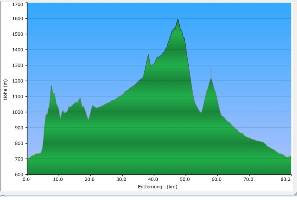
Carte du tour et altitude
Minimum height 702 m
Maximum height 1596 m
More about the tour author
|
|
pinarello1 |
Commentaires

Tracks GPS
Trackpoints-
GPX / Garmin Map Source (gpx) download
-
TCX / Garmin Training Center® (tcx) download
-
CRS / Garmin Training Center® (crs) download
-
Google Earth (kml) download
-
G7ToWin (g7t) download
-
TTQV (trk) download
-
Overlay (ovl) download
-
Fugawi (txt) download
-
Kompass (DAV) Track (tk) download
-
Feuille de tours (pdf) download
-
Original file of the author (gpx) download
More about the tour author
|
|
pinarello1 |
Add to my favorites
Remove from my favorites
Edit tags
Open track
My score
Rate