
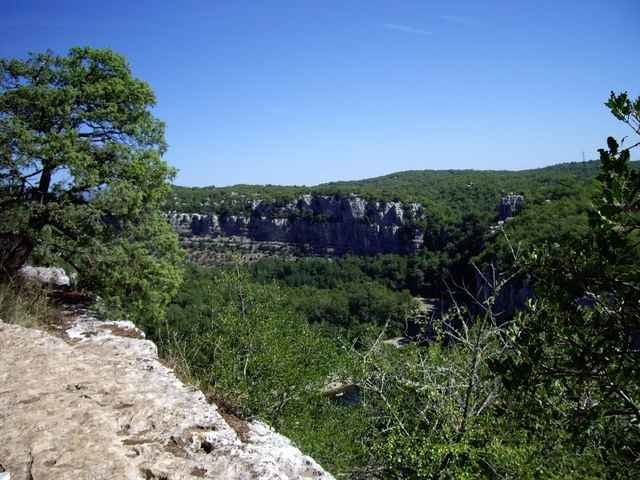

Start: Parking de Lestong. Wanderung oberhalb der steilen (nichts für unachtsame Kinder) Felswandschluchten des Chassezac und durch den beeindruckenden Steinwald (le bois de Païolive). Teilweise klettern über Felsen und wandern auf steinigen Pfaden, festes Schuhwerk empfohlen. Im Tal liegt der Chassezac, ein wunderschöner Nebenfluß der Ardèche.
Weiterführender Link auf Französisch
Weiterführender Link auf Französisch
Further information at
http://www.chez.com/lieuxinsolites/ardeche/paiolive/paiolive.phpGalerie du tour

Carte du tour et altitude
Minimum height 189 m
Maximum height 258 m
More about the tour author

|
christiankrier |
Commentaires

Tracks GPS
Trackpoints-
GPX / Garmin Map Source (gpx) download
-
TCX / Garmin Training Center® (tcx) download
-
CRS / Garmin Training Center® (crs) download
-
Google Earth (kml) download
-
G7ToWin (g7t) download
-
TTQV (trk) download
-
Overlay (ovl) download
-
Fugawi (txt) download
-
Kompass (DAV) Track (tk) download
-
Feuille de tours (pdf) download
-
Original file of the author (gpx) download
More about the tour author
|
|
christiankrier |
Add to my favorites
Remove from my favorites
Edit tags
Open track
My score
Rate