Login

Login oublié ?

Cookies have to be accepted!
Your browser's cookie functionality is disabled. Please enable this functionality.

Not a member yet?

Register now
Login

Available for registred users only

Log in to use this feature.

Login oublié ?

Cookies have to be accepted!
Your browser's cookie functionality is disabled. Please enable this functionality.

Not a member yet?

Register now
Filter
Catégories
Advanced filters
  • Longueur (km)
  • Altimètre
Enregistrer le filtre Reset filter

TrackRank

QRCode

Technical data

Longueur2,0 km Altimètre161 m Way down136 m Durée00:00 h:m Date23.04.2010
Evaluations Author Paysage Aspect amusement Condition Technique

Statistiques

1366 Vues Evaluations 100 Téléchargements Moyenne
Rate
  • Feuille de tours
  • Arrivée
  • Téléchargements

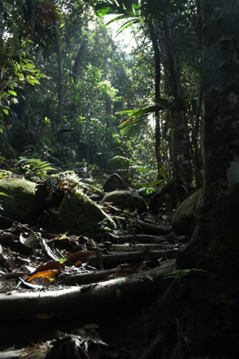
Um 8:30 holte uns unserer Pfadführer namens Basil im Hotel ab und brachte zum Pfad Sans Sousi.
Ich war sehr froh, in guter Form zu sein, da das was wir taten, man nur bedingt wandern nennen konnte. Der enge Pfad zwischen Abgrund und Bäumen oder Steinen ging entweder steil Berg auf oder ab. Der Pfad ist für solche Touristen wie wir sehr liebevoll mit Wurzeln oder Steinen präpariert, was nicht bedeutet, dass es einfach war, Basil zu folgen. Er gab immer exakte Abweisungen, wo man den Fuß setzen soll und welche Bäume oder Steine man als Stütze benutzen soll.

Further information at

http://www.ptiz.de/unterwegs/seychellen/tag4.shtml

Galerie du tour

Carte du tour et altitude

  • Open Street Map
  • Google
Minimum height 340 m Maximum height 487 m Vue de détail

More about the tour author

sova
Member since 2010

Send private message

Commentaires

Tracks GPS

Trackpoints
  • GPX / Garmin Map Source (gpx) download
  • TCX / Garmin Training Center® (tcx) download
  • CRS / Garmin Training Center® (crs) download
  • Google Earth (kml) download
  • G7ToWin (g7t) download
  • TTQV (trk) download
  • Overlay (ovl) download
  • Fugawi (txt) download
  • Kompass (DAV) Track (tk) download
  • Feuille de tours (pdf) download
  • Original file of the author (gpx) download

More about the tour author

sova
Member since 2010

Send private message
Share track
Add to my favorites
Remove from my favorites
Edit tags
My score
Rate
Tour: Bergwanderung auf Peak Copolia auf Mahe, Seychellen
Cat.: Tour en montagne
Longueur: 2,0 km
Evaluated on:
Durée:
Day(s)
Hour(s)
Minute(s)
Evaluation: Paysage Aspect amusement Condition Technique